
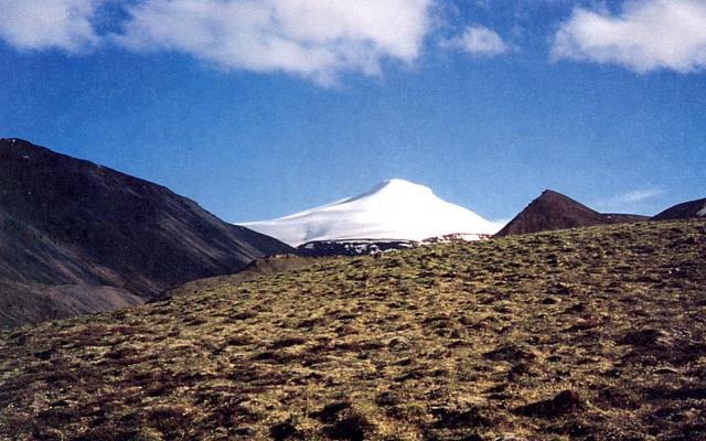
Nabesna Glacier — a glacier in Copper River Census Area, Alaska — is a popular subject for landscape photographers. It is part of Wrangell–St. Elias National Park and Preserve.
Nabesna Glacier is a glacier in the U.S. state of Alaska. Fed by deep snowfall in the Wrangell Mountains, the 53 mile (85 km) long Nabesna is the longest valley glacier in North America and the world's longest interior valley glacier. The glacier flows from an extensive icefield which covers the northern flanks of 14,163 feet (4,317 m) Mount Wrangell, a large shield volcano. It heads initially east past other volcanic peaks including Mount Blackburn and Atna Peaks and then turns north to its terminus near 3,000 ft (900 m) elevation, about 15 mi (24 km) south of the old mining settlement of Nabesna at the end of the Nabesna Road. The vast expanse and length of the Nabesna is fed by approximately 40 tributary glaciers. Melting ice at its terminus forms the Nabesna River, which flows northward through Tetlin National Wildlife Refuge and into the Tanana River.From the Wikipedia article “Nabesna Glacier”, licensed under CC BY-SA 4.0.
Sunrise & sunset directions
At Nabesna Glacier the sunrise point swings a long way through the year: about 29° (NNE) at the June solstice and 145° (SE) in late December. Sunset moves from 331° (NNW) in June to 215° (SW) in December, and the midday sun climbs to 52° in summer but only 5° in winter.
| Date | Sunrise | Azimuth | Sunset | Azimuth | Noon sun | Daylight |
|---|---|---|---|---|---|---|
| March equinox (Mar 20) | 7:34 AM | 89° E | 7:47 PM | 272° W | 28° | 12h 13m |
| June solstice (Jun 21) | 3:44 AM | 29° NNE | 11:26 PM | 331° NNW | 52° | 19h 43m |
| September equinox (Sep 22) | 7:17 AM | 88° E | 7:35 PM | 272° W | 28° | 12h 18m |
| December solstice (Dec 21) | 9:56 AM | 145° SE | 3:07 PM | 215° SW | 5° | 5h 10m |
Azimuth is measured clockwise from true north (90° = east, 270° = west). Computed for 2026; values change by less than a degree from year to year.
Golden hour & blue hour by month
Ice shows its blue best under overcast skies or in shade; bright sun turns glaciers white and flat.
| Month (15th) | Blue hour starts | Sunrise | Golden hour ends | Golden hour starts | Sunset | Blue hour ends | Daylight |
|---|---|---|---|---|---|---|---|
| January | 8:38 AM | 9:37 AM | 11:38 AM | 1:47 PM | 3:48 PM | 4:46 PM | 6h 11m |
| February | 7:32 AM | 8:19 AM | 9:29 AM | 4:06 PM | 5:16 PM | 6:03 PM | 8h 58m |
| March | 7:06 AM | 7:50 AM | 8:49 AM | 6:35 PM | 7:34 PM | 8:18 PM | 11h 44m |
| April | 5:19 AM | 6:09 AM | 7:10 AM | 7:56 PM | 8:57 PM | 9:47 PM | 14h 47m |
| May | 3:24 AM | 4:40 AM | 5:53 AM | 9:06 PM | 10:20 PM | 11:35 PM | 17h 40m |
| June | — | 3:44 AM | 5:16 AM | 9:52 PM | 11:23 PM | — | 19h 39m |
| July | 2:28 AM | 4:17 AM | 5:39 AM | 9:39 PM | 11:01 PM | 12:50 AM | 18h 44m |
| August | 4:41 AM | 5:38 AM | 6:43 AM | 8:33 PM | 9:37 PM | 10:34 PM | 15h 59m |
| September | 6:14 AM | 6:59 AM | 7:57 AM | 6:59 PM | 7:58 PM | 8:43 PM | 12h 58m |
| October | 7:32 AM | 8:17 AM | 9:21 AM | 5:17 PM | 6:20 PM | 7:05 PM | 10h 03m |
| November | 7:51 AM | 8:44 AM | 10:17 AM | 2:19 PM | 3:51 PM | 4:45 PM | 7h 07m |
| December | 8:46 AM | 9:51 AM | — | — | 3:06 PM | 4:11 PM | 5h 15m |
Local time (America/Anchorage), including daylight saving time. Golden hour runs from about −4° to +6° solar altitude, so the morning golden hour begins during blue hour, before sunrise.
Milky Way & night sky
The Milky Way's bright core (in Sagittarius) barely clears the southern horizon at this latitude, so focus on winter Milky Way, aurora or star trails instead.
| Month | Core visible (15th) | Hours | Max altitude | Direction |
|---|---|---|---|---|
| January | Below 10° in darkness | — | -13° | — |
| February | Below 10° in darkness | — | -8° | — |
| March | Below 10° in darkness | — | -6° | — |
| April | Below 10° in darkness | — | -3° | — |
| May | No darkness | — | — | — |
| June | No darkness | — | — | — |
| July | No darkness | — | — | — |
| August | Below 10° in darkness | — | -6° | — |
| September | Below 10° in darkness | — | -8° | — |
| October | Below 10° in darkness | — | -8° | — |
| November | Below 10° in darkness | — | -12° | — |
| December | Below 10° in darkness | — | -22° | — |
Window when the galactic core is at least 10° high during astronomical darkness on the 15th of each month. Pick nights within a few days of the new moon. Plan exact nights with the Milky Way planner.
Estimated sky darkness: 1 Bortle 1 — Excellent dark-sky site. The Milky Way casts faint shadows; zodiacal light and airglow are obvious. Modeled zenith brightness ≈ 21.95 mag/arcsec². Aurora needs roughly Kp 0.0+ to show low on the northern horizon here.
Weather & best season
Long-term NASA satellite data for this area show March as the clearest month (about 59% average cloud cover) and June as the cloudiest (80%). July is the warmest month and January the coldest, which matters for gear, snow access and how long batteries last at night.
Average cloud cover (%)
| Jan | Feb | Mar | Apr | May | Jun | Jul | Aug | Sep | Oct | Nov | Dec | |
|---|---|---|---|---|---|---|---|---|---|---|---|---|
| High °F | 34 | 33 | 40 | 50 | 54 | 63 | 63 | 68 | 56 | 44 | 32 | 31 |
| Low °F | -36 | -35 | -35 | -21 | 6 | 20 | 25 | 21 | 10 | -18 | -31 | -28 |
| Precip. (in) | 5.3 | 4.5 | 3.6 | 3.2 | 3.7 | 3.6 | 5.1 | 7.5 | 8.9 | 7.1 | 5.9 | 6.0 |
Monthly climatology for the surrounding 1° grid cell from NASA POWER (MERRA-2). Mountain sites can be colder and cloudier than the cell average.
Photography tips for this glacier
- Never walk on a glacier without training and gear; crevasses hide under snow bridges.
- Expose carefully: ice and snow fool meters into underexposure, so add +1 to +2 stops.
- A polarizer deepens the blue of glacial ice and the turquoise of meltwater lakes.
- Include a person or boat for scale — glaciers are much larger than they look.
- Boat tours to tidewater glaciers offer calving shots; use fast shutter speeds and a telephoto.
- Scout in daylight if you plan to shoot at night or before sunrise.
Season: Summer offers access; late summer exposes the most bare ice before new snow.
Suggested gear: Telephoto lens, Polarizer, Waterproof shell, Spare batteries (cold drains them). Work out exposures with the depth of field, ND filter and NPF rule calculators.
Nearby photo spots
Other locations within 25 km of Nabesna Glacier, closest first.


FAQ
When is the best time to photograph Nabesna Glacier?
What time is golden hour at Nabesna Glacier?
Where does the sun rise and set at Nabesna Glacier?
Can you see the Milky Way from Nabesna Glacier?
Do you need a permit to photograph at Nabesna Glacier?
Sources
Location data: Wikidata, Wikipedia. Sun, moon and Milky Way times are computed by LWPhoto Atlas for 2026. Climate: NASA POWER. Sky darkness is a population-based estimate (Walker's law), not a measurement. See data sources & licenses.