Top lighthouses
 Lighthouse
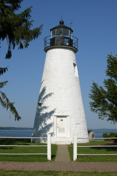
Concord Point Light
 Lighthouse
Piney Point Light
 Lighthouse
Point Lookout Light
 Lighthouse
Turkey Point Light
 Lighthouse
Cobb Point Bar Light
 Lighthouse
Thomas Point Shoal Light
 Lighthouse
Cedar Point Light
 Lighthouse
Cove Point Light
 Lighthouse
Hooper Island Light
 Lighthouse
Love Point Light
 Lighthouse
Point No Point Light
 Lighthouse
Sandy Point Shoal Light
Lighthouses by county
- Anne Arundel County8
- Baltimore County6
- Calvert County4
- City of Baltimore5
- Dorchester County4
- Saint Mary's County7
- Somerset County5
All lighthouses (52)
| Name | County | Elevation | Nearest town | Sky |
|---|---|---|---|---|
| Concord Point LightStar-Spangled Banner | Harford County | 1 m | Havre de Grace | 6 |
| Piney Point Light | Saint Mary's County | 1 m | Lexington Park | 4 |
| Point Lookout Light | Saint Mary's County | 1 m | Lexington Park | 3 |
| Turkey Point Light | Cecil County | 28 m | Aberdeen Proving Ground | 5 |
| Cobb Point Bar Light | Saint Mary's County | -2 m | Cobb Island | 4 |
| Thomas Point Shoal Light | Anne Arundel County | — | Mayo | 5 |
| Cedar Point Light | Saint Mary's County | — | Drum Point | 5 |
| Cove Point Light | Calvert County | — | Chesapeake Ranch Estates-Drum Point | 5 |
| Hooper Island Light | Dorchester County | — | Drum Point | 4 |
| Love Point Light | Queen Anne's County | — | Stevensville | 5 |
| Point No Point Light | Saint Mary's County | — | Lexington Park | 4 |
| Sandy Point Shoal Light | Anne Arundel County | — | Cape Saint Claire | 6 |
| Holland Island Bar Light | Dorchester County | — | Crisfield | 3 |
| Somers Cove Light | Somerset County | — | Crisfield | 4 |
| Sharps Island Light | Talbot County | — | Chesapeake Beach | 4 |
| Craighill Channel Upper Range Front Light | Baltimore County | — | Edgemere | 7 |
| Drum Point Light | Calvert County | — | Solomons | 6 |
| Fort Washington LightFort Washington | Prince George's County | — | Fort Washington | 8 |
| Baltimore Harbor Light | Anne Arundel County | — | Cape Saint Claire | 6 |
| Blakistone Island Light | Saint Mary's County | — | Cobb Island | 4 |
| Bloody Point Bar Light | Queen Anne's County | — | Shady Side | 5 |
| Hooper Strait Light | Dorchester County | — | Drum Point | 4 |
| Lazaretto Point LightFort McHenry | City of Baltimore | — | Locust Point | 8 |
| Mathias Point Light | Charles County | — | Dahlgren | 5 |
| Pooles Island Light | Kent County | — | Bowleys Quarters | 5 |
| Seven Foot Knoll LightStar-Spangled Banner | City of Baltimore | — | Inner Harbor | 9 |
| Solomons Lump Light | Somerset County | — | Crisfield | 3 |
| Choptank River Light | Talbot County | — | Algonquin | 4 |
| Craighill Channel Lower Range Front Light | Baltimore County | — | Edgemere | 6 |
| Craighill Channel Lower Range Rear Light | Baltimore County | — | Edgemere | 6 |
| Craighill Channel Upper Range Rear Light | Baltimore County | — | Edgemere | 7 |
| Fishing Battery Light | Harford County | — | Aberdeen Proving Ground | 5 |
| Fort Carroll Light | Baltimore County | — | Dundalk | 8 |
| Greenbury Point Light | Anne Arundel County | — | Naval Academy | 7 |
| Bodkin Island Light | Anne Arundel County | — | Lake Shore | 6 |
| Sharkfin Shoal Light | Dorchester County | — | Princess Anne | 3 |
| Great Shoals Light | Somerset County | — | Princess Anne | 3 |
| Hawkins Point Light | Anne Arundel County | — | Dundalk | 7 |
| Leading Point Light | City of Baltimore | — | Curtis Bay | 8 |
| Lower Cedar Point Light | Charles County | — | Dahlgren | 5 |
| Triton LightCaptain John Smith Chesapeake | Anne Arundel County | — | Naval Academy | 7 |
| Clay Island Light | Wicomico County | — | Princess Anne | 3 |
| Fog Point Light | Somerset County | — | Crisfield | 3 |
| North Point Range Lights | Baltimore County | — | Edgemere | 7 |
| Janes Island Light | Somerset County | — | Crisfield | 3 |
| Lazaretto LighthouseFort McHenry | City of Baltimore | 1 m | Locust Point | 8 |
| Sevenfoot Knoll LighthouseStar-Spangled Banner | City of Baltimore | 1 m | Inner Harbor | 9 |
| Links at Lighthouse Sound | Worcester County | 2 m | Ocean Pines | 5 |
| Solomon Lighthouse (historical) | Calvert County | 2 m | Solomons | 6 |
| Baltimore Lighthouse | Anne Arundel County | — | Cape Saint Claire | 6 |
| Drum Point Lighthouse | Calvert County | — | Drum Point | 6 |
| Saint Clements Island Lighthouse | Saint Mary's County | — | Cobb Island | 4 |
Sky = estimated Bortle class (1 darkest – 9 brightest).
Map
How to photograph lighthouses
Lighthouses work at both ends of the day: blue hour when the beacon is lit, and golden hour when white towers take on warm tones.
- During blue hour, use 5–15 second exposures to capture the beam; check whether the light is still active.
- Shoot from the beach or a jetty to place the tower against open sky and sea.
- Stormy weather and crashing surf add drama; keep a safe distance from waves on rocks and piers.
- A telephoto from across a bay compresses the tower against cliffs or the moon.
- Many lighthouses are on private or Coast Guard property — check public access and opening hours.
Season: Summer brings open towers and tours; autumn and winter offer storms, fewer crowds and lower sun angles.