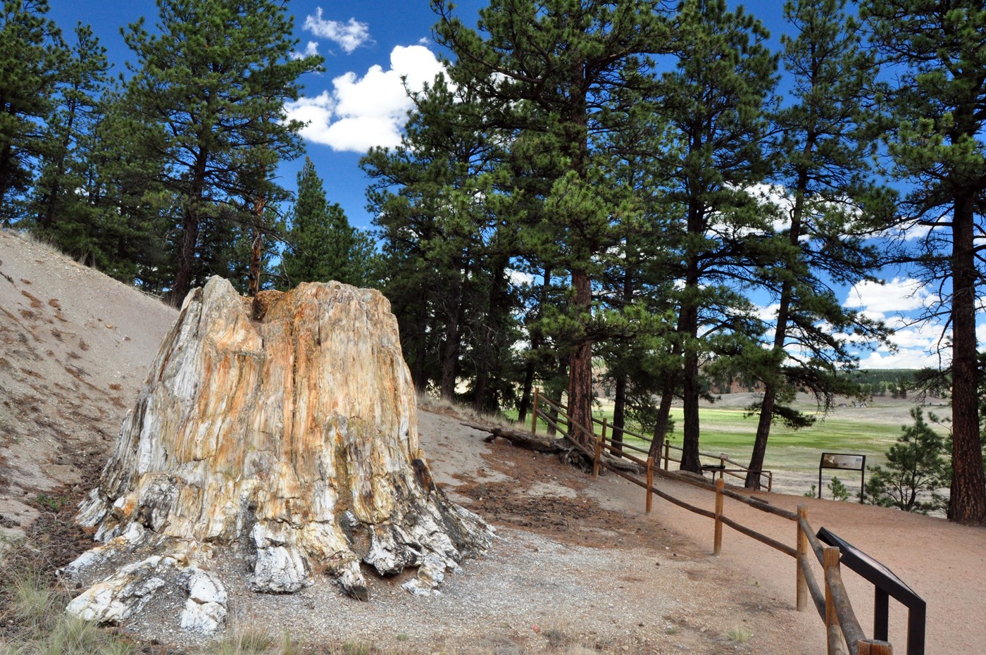
Florissant Fossil Beds National Monument is a National Monument in Colorado. This guide combines the park's official information with computed sunrise, sunset and Milky Way times, satellite climate data and 1 photo locations inside or next to the park.
Best photo spots in Florissant Fossil Beds
We matched 1 named overlooks, waterfalls, peaks and other features to Florissant Fossil Beds. Each has its own page with sun directions and a monthly golden hour table.
Dark Sky Places (1)

Sunrise, sunset & golden hour
At Florissant Fossil Beds the sunrise point swings a long way through the year: about 59° (ENE) at the June solstice and 120° (ESE) in late December. Sunset moves from 302° (WNW) in June to 240° (WSW) in December, and the midday sun climbs to 75° in summer but only 28° in winter.
| Month (15th) | Sunrise | Golden hour ends | Golden hour starts | Sunset | Sunset az. | Daylight |
|---|---|---|---|---|---|---|
| January | 7:19 AM | 7:59 AM | 4:23 PM | 5:03 PM | 243° | 9h 44m |
| February | 6:53 AM | 7:30 AM | 5:02 PM | 5:39 PM | 255° | 10h 46m |
| March | 7:13 AM | 7:49 AM | 6:33 PM | 7:08 PM | 268° | 11h 55m |
| April | 6:25 AM | 7:01 AM | 7:02 PM | 7:38 PM | 284° | 13h 13m |
| May | 5:49 AM | 6:27 AM | 7:29 PM | 8:07 PM | 296° | 14h 18m |
| June | 5:36 AM | 6:16 AM | 7:49 PM | 8:29 PM | 302° | 14h 53m |
| July | 5:49 AM | 6:28 AM | 7:48 PM | 8:27 PM | 299° | 14h 38m |
| August | 6:16 AM | 6:52 AM | 7:21 PM | 7:58 PM | 289° | 13h 42m |
| September | 6:43 AM | 7:18 AM | 6:36 PM | 7:11 PM | 275° | 12h 28m |
| October | 7:11 AM | 7:47 AM | 5:48 PM | 6:24 PM | 260° | 11h 13m |
| November | 6:45 AM | 7:24 AM | 4:09 PM | 4:49 PM | 247° | 10h 04m |
| December | 7:13 AM | 7:55 AM | 3:59 PM | 4:41 PM | 240° | 9h 27m |
Computed for the park's reference point (38.9126, -105.2803); large parks span several minutes of difference.
Milky Way & dark skies
From Florissant Fossil Beds, the Milky Way core is visible in a dark sky from March through September. June gives the longest window (about 5.0 hours on a moonless night), and the core peaks around 22° above the southern horizon. Our light-pollution model puts the sky at about Bortle 4 (rural / suburban transition), good enough for detailed Milky Way images.
| Month | Core visible (15th) | Hours | Max altitude |
|---|---|---|---|
| January | Not visible in darkness | — | — |
| February | 5:08 AM – 5:18 AM | 0.2 | 12° |
| March | 4:17 AM – 5:37 AM | 1.3 | 19° |
| April | 2:13 AM – 4:43 AM | 2.5 | 22° |
| May | 12:15 AM – 3:55 AM | 3.7 | 22° |
| June | 10:28 PM – 3:28 AM | 5.0 | 22° |
| July | 10:21 PM – 2:11 AM | 3.8 | 22° |
| August | 9:37 PM – 12:07 AM | 2.5 | 22° |
| September | 8:42 PM – 10:02 PM | 1.3 | 19° |
| October | 7:52 PM – 8:02 PM | 0.2 | 12° |
| November | Not visible in darkness | — | — |
| December | Not visible in darkness | — | — |
4 Estimated Bortle 4 — Rural / suburban transition. Light domes are visible in several directions; the Milky Way is clear but lacks detail near the horizon.
Weather & best time to visit
Winter months - average high 40 degrees F; average low 5 degrees F; Summer months - average high 75 degrees F; average low 40 degrees F;
Weather overview: National Park Service.
Long-term NASA satellite data for this area show September as the clearest month (about 42% average cloud cover) and February as the cloudiest (59%). July is the warmest month and January the coldest, which matters for gear, snow access and how long batteries last at night.
Average cloud cover (%)
Average high (°F)
Photography permits, drones & fees
Permits. Under federal law (54 U.S.C. 100905), still photography in National Park Service areas needs a permit only when it (1) takes place where members of the public are not allowed, (2) uses models, sets or props that are not part of the location's natural or cultural resources or administrative facilities, or (3) would cause the park to incur additional administrative costs to monitor the activity. Ordinary visitor and most landscape photography needs no permit. Commercial filming rules are separate and have changed in recent years — confirm current requirements with the park before a paid shoot.
Drones. Launching, landing or operating unmanned aircraft (drones) is prohibited in National Park Service units under a 2014 Superintendent's closure (36 CFR 1.5), except where a park has issued specific written approval. Flying from outside the boundary over park land can also violate park rules and disturb wildlife.
| Entrance fee | Cost (USD) |
|---|---|
| Entrance - Per Person | $10.00 |
Fees as published by the NPS when this page was built — confirm on nps.gov before you go.
Getting there
Visitors traveling north/south on I-25: Exit at US 24 West, travel 35 miles to town of Florissant, then follow signs two miles south on Teller County Road 1 to the Visitor Center. Visitors traveling from town of Cripple Creek: Follow Teller County Road 1 north for 16 miles.
Directions: National Park Service.
Activities
- Astronomy
- Stargazing
- Food
- Picnicking
- Guided Tours
- Self-Guided Tours - Walking
- Hiking
- Backcountry Hiking
- Front-Country Hiking
- Horse Trekking
- Horseback Riding
- Junior Ranger Program
- Snowshoeing
- Park Film
- Museum Exhibits
- Shopping
- Bookstore and Park Store
Nearby parks
 CO
 CO
 CO
 CO