
Sea Rim State Park — a state park in Jefferson County, Texas — is a popular subject for landscape photographers. The nearest town is Port Arthur, about 22 km (14 mi) away (Sea Rim State Park lies SSW of town).
Sea Rim State Park is a 4,141-acre (1,676 ha) state park in southeast Texas. The park is located on the Gulf of Mexico in southern Jefferson County, south of Port Arthur and just west of Sabine Pass. The park was closed for several years due to extensive damage from Hurricanes Rita (2005) and Ike (2008). The park reopened in 2010.From the Wikipedia article “Sea Rim State Park”, licensed under CC BY-SA 4.0.
Sunrise & sunset directions
At Sea Rim State Park the sunrise point swings a long way through the year: about 62° (ENE) at the June solstice and 117° (ESE) in late December. Sunset moves from 298° (WNW) in June to 243° (WSW) in December, and the midday sun climbs to 84° in summer but only 37° in winter.
| Date | Sunrise | Azimuth | Sunset | Azimuth | Noon sun | Daylight |
|---|---|---|---|---|---|---|
| March equinox (Mar 20) | 7:21 AM | 90° E | 7:28 PM | 271° W | 60° | 12h 07m |
| June solstice (Jun 21) | 6:17 AM | 62° ENE | 8:20 PM | 298° WNW | 84° | 14h 03m |
| September equinox (Sep 22) | 7:05 AM | 89° E | 7:14 PM | 271° W | 61° | 12h 09m |
| December solstice (Dec 21) | 7:08 AM | 117° ESE | 5:22 PM | 243° WSW | 37° | 10h 14m |
Azimuth is measured clockwise from true north (90° = east, 270° = west). Computed for 2026; values change by less than a degree from year to year.
Golden hour & blue hour by month
State parks often protect a signature feature — a gorge, lake or overlook — that is best in early morning before visitors and harsh light arrive.
| Month (15th) | Blue hour starts | Sunrise | Golden hour ends | Golden hour starts | Sunset | Blue hour ends | Daylight |
|---|---|---|---|---|---|---|---|
| January | 6:47 AM | 7:13 AM | 7:48 AM | 5:04 PM | 5:39 PM | 6:05 PM | 10h 27m |
| February | 6:32 AM | 6:57 AM | 7:29 AM | 5:33 PM | 6:06 PM | 6:30 PM | 11h 09m |
| March | 7:03 AM | 7:27 AM | 7:58 AM | 6:53 PM | 7:25 PM | 7:49 PM | 11h 58m |
| April | 6:26 AM | 6:50 AM | 7:22 AM | 7:11 PM | 7:43 PM | 8:08 PM | 12h 53m |
| May | 5:58 AM | 6:24 AM | 6:58 AM | 7:29 PM | 8:03 PM | 8:29 PM | 13h 38m |
| June | 5:49 AM | 6:16 AM | 6:51 AM | 7:44 PM | 8:19 PM | 8:46 PM | 14h 02m |
| July | 6:00 AM | 6:26 AM | 7:01 AM | 7:45 PM | 8:19 PM | 8:46 PM | 13h 52m |
| August | 6:20 AM | 6:45 AM | 7:17 AM | 7:26 PM | 7:58 PM | 8:23 PM | 13h 13m |
| September | 6:38 AM | 7:02 AM | 7:33 AM | 6:51 PM | 7:23 PM | 7:47 PM | 12h 21m |
| October | 6:54 AM | 7:18 AM | 7:50 AM | 6:15 PM | 6:47 PM | 7:11 PM | 11h 28m |
| November | 6:16 AM | 6:42 AM | 7:16 AM | 4:48 PM | 5:22 PM | 5:47 PM | 10h 40m |
| December | 6:38 AM | 7:05 AM | 7:41 AM | 4:44 PM | 5:20 PM | 5:46 PM | 10h 15m |
Local time (America/Chicago), including daylight saving time. Golden hour runs from about −4° to +6° solar altitude, so the morning golden hour begins during blue hour, before sunrise.
Milky Way & night sky
From Sea Rim State Park, the Milky Way core is visible in a dark sky from February through October. June gives the longest window (about 6.7 hours on a moonless night), and the core peaks around 31° above the southern horizon. Our light-pollution model puts the sky at about Bortle 3 (rural sky), good enough for detailed Milky Way images.
| Month | Core visible (15th) | Hours | Max altitude | Direction |
|---|---|---|---|---|
| January | Below 10° in darkness | — | 2° | — |
| February | 4:36 AM – 5:26 AM | 0.8 | 18° | SE → SE |
| March | 3:44 AM – 6:04 AM | 2.3 | 28° | SE → SSE |
| April | 1:46 AM – 5:16 AM | 3.5 | 31° | SE → S |
| May | 11:43 PM – 4:53 AM | 5.2 | 31° | SE → SSW |
| June | 9:55 PM – 4:35 AM | 6.7 | 31° | SE → SW |
| July | 9:52 PM – 3:12 AM | 5.3 | 31° | SSE → SW |
| August | 9:24 PM – 1:04 AM | 3.7 | 31° | S → SW |
| September | 8:43 PM – 11:03 PM | 2.3 | 28° | SSW → SW |
| October | 8:06 PM – 9:06 PM | 1.0 | 20° | SW → SW |
| November | Below 10° in darkness | — | 4° | — |
| December | Below 10° in darkness | — | -18° | — |
Window when the galactic core is at least 10° high during astronomical darkness on the 15th of each month. Pick nights within a few days of the new moon. Plan exact nights with the Milky Way planner.
Estimated sky darkness: 3 Bortle 3 — Rural sky. Some light domes sit on the horizon, but the Milky Way still looks complex overhead. Modeled zenith brightness ≈ 21.36 mag/arcsec².
Weather & best season
Long-term NASA satellite data for this area show October as the clearest month (about 38% average cloud cover) and February as the cloudiest (64%). August is the warmest month and January the coldest, which matters for gear, snow access and how long batteries last at night.
Average cloud cover (%)
| Jan | Feb | Mar | Apr | May | Jun | Jul | Aug | Sep | Oct | Nov | Dec | |
|---|---|---|---|---|---|---|---|---|---|---|---|---|
| High °F | 71 | 72 | 77 | 87 | 90 | 95 | 92 | 97 | 94 | 87 | 81 | 74 |
| Low °F | 27 | 28 | 33 | 43 | 52 | 71 | 74 | 71 | 64 | 46 | 40 | 35 |
| Precip. (in) | 5.0 | 3.5 | 3.8 | 4.3 | 5.4 | 6.8 | 6.0 | 7.5 | 8.1 | 6.1 | 4.3 | 5.0 |
Monthly climatology for the surrounding 1° grid cell from NASA POWER (MERRA-2). Mountain sites can be colder and cloudier than the cell average.
Photography tips for this state park
- Weekday mornings are the least crowded at popular viewpoints.
- Trail maps often mark overlooks — combine them with the sun azimuth to plan.
- Day-use fees or passes are common; buy them online before arriving.
- Check park hours: many state parks close at dusk, which affects sunset and night shooting.
- Ask rangers about photography permits for commercial work, models or drones.
- Check road and trail conditions with the managing agency before you go.
Season: Spring wildflowers and autumn color are peak seasons in most parks.
Suggested gear: Versatile zoom lens, Tripod, Park pass. Work out exposures with the depth of field, ND filter and NPF rule calculators.
Permits, drones & access
Drones: Drone rules in state parks vary by state and even by park — many require a permit or ban recreational drone flights. Check the park's rules and the FAA B4UFLY app before flying.
Nearby photo spots
Other locations within 40 km of Sea Rim State Park, closest first.
 National Wildlife Refuge
 National Wildlife Refuge
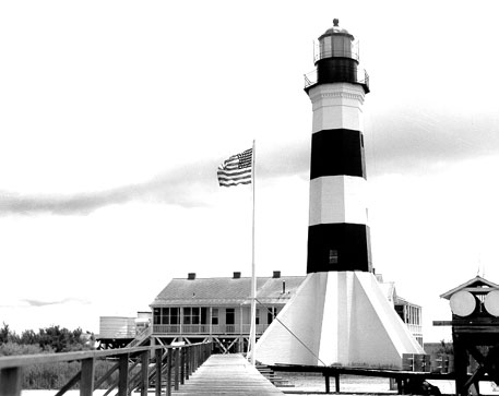 Lighthouse
 Lake
 Botanical Garden
 Lighthouse
FAQ
When is the best time to photograph Sea Rim State Park?
What time is golden hour at Sea Rim State Park?
Where does the sun rise and set at Sea Rim State Park?
Can you see the Milky Way from Sea Rim State Park?
Do you need a permit to photograph at Sea Rim State Park?
How far is Sea Rim State Park from Port Arthur?
Sources
Location data: Wikidata, Wikipedia. Sun, moon and Milky Way times are computed by LWPhoto Atlas for 2026. Climate: NASA POWER. Sky darkness is a population-based estimate (Walker's law), not a measurement. See data sources & licenses.