Top wilderness areas
 Wilderness Area
Mount Hood Wilderness
 Wilderness Area
Badger Creek Wilderness
 Wilderness Area
Bull of the Woods Wilderness
 Wilderness Area
Diamond Peak Wilderness
 Wilderness Area
Opal Creek Wilderness
 Wilderness Area
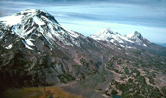
Three Sisters Wilderness
 Wilderness Area
Mount Jefferson Wilderness
 Wilderness Area
Boulder Creek Wilderness
 Wilderness Area
Kalmiopsis Wilderness
 Wilderness Area
Mark O. Hatfield Wilderness
 Wilderness Area
Middle Santiam Wilderness
 Wilderness Area
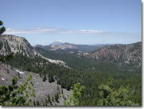
Mountain Lakes Wilderness
Wilderness Areas by county
- Curry County3
- Deschutes County3
- Douglas County3
- Grant County3
- Klamath County3
- Lane County3
- Linn County3
- Marion County4
- Wasco County3
All wilderness areas (44)
| Name | County | Elevation | Nearest town | Sky |
|---|---|---|---|---|
| Mount Hood Wilderness | Clackamas County | — | Mount Hood Village | 3 |
| Badger Creek Wilderness | Wasco County | — | Odell | 3 |
| Bull of the Woods Wilderness | Marion County | — | Mill City | 3 |
| Diamond Peak Wilderness | Klamath County | — | Oakridge | 2 |
| Opal Creek Wilderness | Marion County | — | Mill City | 3 |
| Three Sisters Wilderness | Deschutes County | — | Deschutes River Woods | 4 |
| Mount Jefferson Wilderness | Linn County | — | Warm Springs | 2 |
| Boulder Creek Wilderness | Douglas County | — | Oakridge | 2 |
| Kalmiopsis Wilderness | Josephine County | — | Cave Junction | 2 |
| Mark O. Hatfield Wilderness | Hood River County | — | Cascade Locks | 3 |
| Middle Santiam Wilderness | Linn County | — | Mill City | 3 |
| Mountain Lakes Wilderness | Klamath County | — | Klamath Falls | 2 |
| Rogue–Umpqua Divide Wilderness | Jackson County | — | Glide | 2 |
| Sky Lakes Wilderness | Klamath County | — | Shady Cove | 2 |
| Mount Thielsen Wilderness | Douglas County | — | Deschutes River Woods | 2 |
| Mount Washington Wilderness | Deschutes County | — | Sisters | 2 |
| Strawberry Mountain Wilderness | Grant County | — | John Day | 1 |
| Oregon Badlands Wilderness | Deschutes County | — | Bend | 3 |
| Monument Rock Wilderness | Baker County | — | John Day | 1 |
| Bridge Creek Wilderness | Wheeler County | — | Prineville | 2 |
| Drift Creek Wilderness | Lincoln County | — | Waldport | 3 |
| Waldo Lake Wilderness | Lane County | — | Oakridge | 2 |
| Gearhart Mountain Wilderness | Lake County | — | Lakeview | 1 |
| Lower White River Wilderness | Wasco County | — | Warm Springs | 3 |
| Devil's Staircase Wilderness | Douglas County | — | Reedsport | 2 |
| Spring Basin Wilderness | Wasco County | — | Madras | 2 |
| Steens Mountain Wilderness | Harney County | — | Caldwell | 1 |
| Wenaha–Tucannon Wilderness | Wallowa County | — | Dayton | 2 |
| Wild Rogue Wilderness | Curry County | — | Gold Beach | 2 |
| Table Rock Wilderness | Marion County | — | Mill City | 3 |
| North Fork John Day Wilderness | Grant County | — | La Grande | 1 |
| North Fork Umatilla Wilderness | Umatilla County | — | Elgin | 2 |
| Red Buttes Wilderness | Josephine County | — | Happy Camp | 2 |
| Soda Mountain Wilderness | Jackson County | — | Ashland | 2 |
| Black Canyon Wilderness | Grant County | — | John Day | 1 |
| Clackamas Wilderness | Marion County | — | Warm Springs | 3 |
| Cummins Creek Wilderness | Lane County | — | Waldport | 2 |
| Grassy Knob Wilderness | Curry County | — | Port Orford | 1 |
| Eagle Cap Wilderness | Wallowa County | — | Joseph | 1 |
| Rock Creek Wilderness | Lane County | — | Florence | 2 |
| Mill Creek Wilderness | Jefferson County | — | Prineville | 2 |
| Salmon–Huckleberry Wilderness | Clackamas County | — | Mount Hood Village | 4 |
| Menagerie Wilderness | Linn County | — | Sweet Home | 3 |
| Copper Salmon Wilderness | Curry County | — | Port Orford | 1 |
Sky = estimated Bortle class (1 darkest – 9 brightest).
Map
How to photograph wilderness areas
Wilderness areas reward those who camp: being on location at sunrise and in the dark is the main advantage over day visitors.
- Motorized and mechanized equipment, including drones, is prohibited in designated wilderness.
- Group size limits and permits may apply; check with the managing agency.
- Practice Leave No Trace — camp on durable surfaces away from lakes and streams.
- Pack weight matters: a single zoom and a light tripod cover most situations.
- Night skies are often among the darkest in the country.
Season: Most high wilderness is snow-free from July to September; lower deserts are best in spring and autumn.