
Moosehorn National Wildlife Refuge — a national wildlife refuge in Washington County, Maine — is a popular subject for landscape photographers. It sits roughly 16.8 km (10.4 mi) S of Calais.
Moosehorn National Wildlife Refuge is one of the northernmost National Wildlife Refuges in the Atlantic Flyway, a migratory route that follows the eastern coast of North America. The refuge provides important feeding and nesting habitat for many bird species, including waterfowl, wading birds, shorebirds, upland game birds, songbirds, and birds of prey. The refuge consists of two divisions. The Baring Division covers 20,016 acres (81.00 km2) and is located off U.S. Route 1, southwest of Calais, Maine. The 8,735-acre (35.35 km2) Edmunds Division is between Dennysville and Whiting on U.S. Route 1 and borders the tidal waters of Cobscook Bay. Each division contains a wilderness area, thousands of acres managed to preserve their wild character for future generation. The East Coast Greenway, connecting Calais, Maine to Key West, Florida, runs through part of the refuge.From the Wikipedia article “Moosehorn National Wildlife Refuge”, licensed under CC BY-SA 4.0.
Sunrise & sunset directions
At Moosehorn National Wildlife Refuge the sunrise point swings a long way through the year: about 55° (NE) at the June solstice and 123° (ESE) in late December. Sunset moves from 305° (NW) in June to 237° (WSW) in December, and the midday sun climbs to 68° in summer but only 22° in winter.
| Date | Sunrise | Azimuth | Sunset | Azimuth | Noon sun | Daylight |
|---|---|---|---|---|---|---|
| March equinox (Mar 20) | 6:33 AM | 90° E | 6:42 PM | 271° W | 45° | 12h 08m |
| June solstice (Jun 21) | 4:43 AM | 55° NE | 8:20 PM | 305° NW | 68° | 15h 37m |
| September equinox (Sep 22) | 6:17 AM | 89° E | 6:29 PM | 271° W | 45° | 12h 12m |
| December solstice (Dec 21) | 7:05 AM | 123° ESE | 3:51 PM | 237° WSW | 22° | 8h 46m |
Azimuth is measured clockwise from true north (90° = east, 270° = west). Computed for 2026; values change by less than a degree from year to year.
Golden hour & blue hour by month
Wildlife is most active in the first and last two hours of daylight — exactly when the light is warmest.
| Month (15th) | Blue hour starts | Sunrise | Golden hour ends | Golden hour starts | Sunset | Blue hour ends | Daylight |
|---|---|---|---|---|---|---|---|
| January | 6:32 AM | 7:05 AM | 7:51 AM | 3:27 PM | 4:14 PM | 4:46 PM | 9h 09m |
| February | 6:01 AM | 6:31 AM | 7:13 AM | 4:16 PM | 4:57 PM | 5:27 PM | 10h 26m |
| March | 6:14 AM | 6:43 AM | 7:22 AM | 5:56 PM | 6:35 PM | 7:04 PM | 11h 52m |
| April | 5:15 AM | 5:45 AM | 6:25 AM | 6:35 PM | 7:14 PM | 7:45 PM | 13h 29m |
| May | 4:27 AM | 5:01 AM | 5:44 AM | 7:09 PM | 7:52 PM | 8:26 PM | 14h 51m |
| June | 4:05 AM | 4:43 AM | 5:28 AM | 7:33 PM | 8:18 PM | 8:56 PM | 15h 36m |
| July | 4:21 AM | 4:57 AM | 5:41 AM | 7:30 PM | 8:14 PM | 8:50 PM | 15h 17m |
| August | 5:00 AM | 5:32 AM | 6:12 AM | 6:57 PM | 7:38 PM | 8:10 PM | 14h 06m |
| September | 5:39 AM | 6:09 AM | 6:47 AM | 6:03 PM | 6:42 PM | 7:12 PM | 12h 34m |
| October | 6:16 AM | 6:45 AM | 7:25 AM | 5:06 PM | 5:46 PM | 6:16 PM | 11h 01m |
| November | 5:56 AM | 6:28 AM | 7:12 AM | 3:17 PM | 4:02 PM | 4:34 PM | 9h 34m |
| December | 6:28 AM | 7:02 AM | 7:50 AM | 3:00 PM | 3:49 PM | 4:23 PM | 8h 47m |
Local time (America/New York), including daylight saving time. Golden hour runs from about −4° to +6° solar altitude, so the morning golden hour begins during blue hour, before sunrise.
Milky Way & night sky
From Moosehorn National Wildlife Refuge, the Milky Way core is visible in a dark sky from April through August. June gives the longest window (about 3.2 hours on a moonless night), and the core peaks around 16° above the southern horizon. Our light-pollution model puts the sky at about Bortle 1 (excellent dark-sky site), which is excellent for astrophotography.
| Month | Core visible (15th) | Hours | Max altitude | Direction |
|---|---|---|---|---|
| January | Below 10° in darkness | — | -4° | — |
| February | Below 10° in darkness | — | 7° | — |
| March | 4:33 AM – 4:53 AM | 0.3 | 12° | SSE → SSE |
| April | 2:32 AM – 3:52 AM | 1.3 | 15° | SSE → S |
| May | 12:30 AM – 2:50 AM | 2.3 | 16° | SSE → S |
| June | 10:51 PM – 2:01 AM | 3.2 | 16° | SSE → SSW |
| July | 10:35 PM – 12:45 AM | 2.2 | 16° | S → SSW |
| August | 9:32 PM – 10:52 PM | 1.3 | 15° | SSW → SSW |
| September | 8:23 PM – 8:43 PM | 0.3 | 12° | SSW → SSW |
| October | Below 10° in darkness | — | 7° | — |
| November | Below 10° in darkness | — | -3° | — |
| December | Below 10° in darkness | — | -20° | — |
Window when the galactic core is at least 10° high during astronomical darkness on the 15th of each month. Pick nights within a few days of the new moon. Plan exact nights with the Milky Way planner.
Estimated sky darkness: 1 Bortle 1 — Excellent dark-sky site. The Milky Way casts faint shadows; zodiacal light and airglow are obvious. Modeled zenith brightness ≈ 21.91 mag/arcsec². Aurora needs roughly Kp 4.0+ to show low on the northern horizon here.
Weather & best season
Long-term NASA satellite data for this area show September as the clearest month (about 56% average cloud cover) and May as the cloudiest (70%). July is the warmest month and January the coldest, which matters for gear, snow access and how long batteries last at night.
Average cloud cover (%)
| Jan | Feb | Mar | Apr | May | Jun | Jul | Aug | Sep | Oct | Nov | Dec | |
|---|---|---|---|---|---|---|---|---|---|---|---|---|
| High °F | 54 | 51 | 72 | 76 | 82 | 89 | 88 | 90 | 89 | 78 | 65 | 57 |
| Low °F | -28 | -25 | -18 | 11 | 27 | 35 | 46 | 43 | 33 | 22 | 4 | -19 |
| Precip. (in) | 3.1 | 3.2 | 3.6 | 3.9 | 3.9 | 4.5 | 3.8 | 3.6 | 3.8 | 5.3 | 4.9 | 5.0 |
Monthly climatology for the surrounding 1° grid cell from NASA POWER (MERRA-2). Mountain sites can be colder and cloudier than the cell average.
Photography tips for this national wildlife refuge
- A 400–600 mm lens (or a crop body) is the usual tool for birds.
- Fast shutter speeds (1/2000 s+) freeze wingbeats; raise ISO rather than lose the shot.
- Migration peaks bring the largest concentrations — see the birding calendar for this state.
- Use auto-loop roads as mobile blinds; animals often tolerate vehicles more than people on foot.
- Stay on designated routes and keep a respectful distance — if an animal changes behavior, you are too close.
- Check road and trail conditions with the managing agency before you go.
Season: Spring and autumn migration are the highlights; winter brings waterfowl to many southern refuges.
Suggested gear: Telephoto lens (400 mm+), Bean bag for car window, Binoculars. Work out exposures with the depth of field, ND filter and NPF rule calculators.
Permits, drones & access
Drones: Launching or landing drones on National Wildlife Refuge lands generally requires a special use permit from the refuge manager, and wildlife disturbance rules apply everywhere.
Nearby photo spots
Other locations within 40 km of Moosehorn National Wildlife Refuge, closest first.
 Waterfall
 Lighthouse
 Lighthouse
 State Park
 State Park
 Scenic ViewpointWaterfallWaterfall
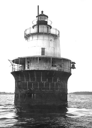 Lighthouse
FAQ
When is the best time to photograph Moosehorn National Wildlife Refuge?
What time is golden hour at Moosehorn National Wildlife Refuge?
Where does the sun rise and set at Moosehorn National Wildlife Refuge?
Can you see the Milky Way from Moosehorn National Wildlife Refuge?
Do you need a permit to photograph at Moosehorn National Wildlife Refuge?
How far is Moosehorn National Wildlife Refuge from Calais?
Sources
Location data: Wikidata, Wikipedia. Sun, moon and Milky Way times are computed by LWPhoto Atlas for 2026. Climate: NASA POWER. Sky darkness is a population-based estimate (Walker's law), not a measurement. See data sources & licenses.