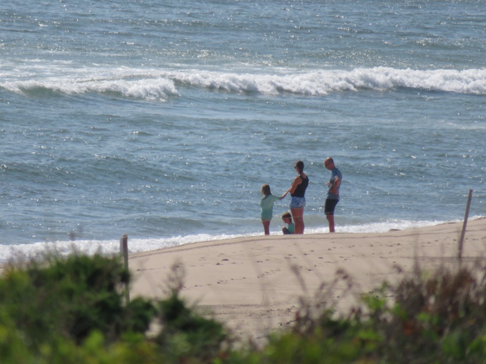
Located in Barnstable County, Massachusetts, Coast Guard Beach is a beach. It lies in or next to Cape Cod National Seashore, so park hours, fees and rules apply. It sits roughly 2.8 km (1.7 mi) ENE of Eastham.
Coast Guard Beach is part of the Cape Cod National Seashore in Eastham, Massachusetts. From mid-June to Labor Day, the parking area at this location is closed to all but park staff and visitors who are disabled, and access is provided by shuttle bus from the Little Creek parking area (across from the Doane Area). Although the parking lot at Coast Guard Beach is open the remainder of the year, parking is limited. There are seasonal restrooms and a wheelchair-accessible rampway to the beach. Coast Guard Beach is popular among locals and tourists for surfing and boogie boarding. It is one of five Cape Cod National Seashore beaches that are on the ocean side of the Cape, generally providing a better surf than beaches on the bay side. Low tide exposes a fairly flat stretch of beach, making it also popular for skimboarding.From the Wikipedia article “Coast Guard Beach (Eastham, Massachusetts)”, licensed under CC BY-SA 4.0.
From the National Park Service
Coast Guard Beach is the southernmost beach managed by Cape Cod National Seashore. It marks the start of what author Henry David Thoreau called the "Great Beach," an uninterrupted sandy coastline stretching north for over 20 miles. Coast Guard is a prime swimming beach during the summer season.
From Memorial Day through mid-September, the primary parking area for this beach is at Little Creek, located a short distance west of the beach on Nauset Road. An open- air shuttle provides transportation to the beach. During the summer, parking at the small lot on the beach is restricted to local residents and vehicles displaying handicap placards. There is a seasonal pet prohibition on the south side of the beach to allow for nesting and migrating shorebirds. Coast Guard Beach is named for the old white Coast Guard building that still stands on the dune above the beach. Nesting and migrating shorebirds share the sand with beachgoers, and seals and sharks are at home in the waters just offshore.
Text: National Park Service (public domain) — nps.gov.
Sunrise & sunset directions
At Coast Guard Beach the sunrise point swings a long way through the year: about 57° (ENE) at the June solstice and 122° (ESE) in late December. Sunset moves from 303° (WNW) in June to 239° (WSW) in December, and the midday sun climbs to 72° in summer but only 25° in winter.
| Date | Sunrise | Azimuth | Sunset | Azimuth | Noon sun | Daylight |
|---|---|---|---|---|---|---|
| March equinox (Mar 20) | 6:44 AM | 90° E | 6:52 PM | 271° W | 48° | 12h 08m |
| June solstice (Jun 21) | 5:06 AM | 57° ENE | 8:19 PM | 303° WNW | 72° | 15h 13m |
| September equinox (Sep 22) | 6:28 AM | 89° E | 6:39 PM | 271° W | 48° | 12h 11m |
| December solstice (Dec 21) | 7:05 AM | 122° ESE | 4:13 PM | 239° WSW | 25° | 9h 08m |
Azimuth is measured clockwise from true north (90° = east, 270° = west). Computed for 2026; values change by less than a degree from year to year.
Golden hour & blue hour by month
Beaches facing east suit sunrise and west-facing beaches suit sunset; wet sand mirrors the sky color during golden hour.
| Month (15th) | Blue hour starts | Sunrise | Golden hour ends | Golden hour starts | Sunset | Blue hour ends | Daylight |
|---|---|---|---|---|---|---|---|
| January | 6:35 AM | 7:06 AM | 7:49 AM | 3:51 PM | 4:34 PM | 5:05 PM | 9h 28m |
| February | 6:08 AM | 6:37 AM | 7:16 AM | 4:34 PM | 5:13 PM | 5:42 PM | 10h 37m |
| March | 6:25 AM | 6:53 AM | 7:30 AM | 6:10 PM | 6:46 PM | 7:14 PM | 11h 54m |
| April | 5:31 AM | 6:00 AM | 6:38 AM | 6:43 PM | 7:21 PM | 7:49 PM | 13h 20m |
| May | 4:49 AM | 5:21 AM | 6:01 AM | 7:13 PM | 7:53 PM | 8:25 PM | 14h 33m |
| June | 4:31 AM | 5:05 AM | 5:47 AM | 7:35 PM | 8:17 PM | 8:51 PM | 15h 12m |
| July | 4:45 AM | 5:18 AM | 6:00 AM | 7:33 PM | 8:14 PM | 8:47 PM | 14h 56m |
| August | 5:19 AM | 5:49 AM | 6:27 AM | 7:03 PM | 7:42 PM | 8:12 PM | 13h 53m |
| September | 5:53 AM | 6:21 AM | 6:57 AM | 6:15 PM | 6:51 PM | 7:19 PM | 12h 31m |
| October | 6:24 AM | 6:53 AM | 7:30 AM | 5:22 PM | 6:00 PM | 6:28 PM | 11h 07m |
| November | 6:00 AM | 6:30 AM | 7:12 AM | 3:39 PM | 4:21 PM | 4:50 PM | 9h 50m |
| December | 6:30 AM | 7:01 AM | 7:46 AM | 3:26 PM | 4:10 PM | 4:42 PM | 9h 09m |
Local time (America/New York), including daylight saving time. Golden hour runs from about −4° to +6° solar altitude, so the morning golden hour begins during blue hour, before sunrise.
Milky Way & night sky
From Coast Guard Beach, the Milky Way core is visible in a dark sky from March through September. June gives the longest window (about 4.3 hours on a moonless night), and the core peaks around 19° above the southern horizon. Our light-pollution model puts the sky at about Bortle 5 (suburban sky), so expect visible sky glow; drive away from towns for better results.
| Month | Core visible (15th) | Hours | Max altitude | Direction |
|---|---|---|---|---|
| January | Below 10° in darkness | — | -3° | — |
| February | Below 10° in darkness | — | 10° | — |
| March | 4:09 AM – 5:09 AM | 1.0 | 16° | SE → SSE |
| April | 2:11 AM – 4:11 AM | 2.0 | 19° | SE → S |
| May | 12:19 AM – 3:19 AM | 3.0 | 19° | SSE → S |
| June | 10:28 PM – 2:48 AM | 4.3 | 19° | SSE → SSW |
| July | 10:18 PM – 1:28 AM | 3.2 | 19° | S → SW |
| August | 9:28 PM – 11:28 PM | 2.0 | 19° | S → SW |
| September | 8:26 PM – 9:26 PM | 1.0 | 16° | SSW → SW |
| October | Below 10° in darkness | — | 10° | — |
| November | Below 10° in darkness | — | -1° | — |
| December | Below 10° in darkness | — | -19° | — |
Window when the galactic core is at least 10° high during astronomical darkness on the 15th of each month. Pick nights within a few days of the new moon. Plan exact nights with the Milky Way planner.
Estimated sky darkness: 5 Bortle 5 — Suburban sky. The Milky Way is weak near the horizon and washed out overhead; long exposures pick up a sky glow. Modeled zenith brightness ≈ 20.17 mag/arcsec². Aurora needs roughly Kp 5.5+ to show low on the northern horizon here.
Weather & best season
Long-term NASA satellite data for this area show September as the clearest month (about 56% average cloud cover) and January as the cloudiest (76%). August is the warmest month and February the coldest, which matters for gear, snow access and how long batteries last at night.
Average cloud cover (%)
| Jan | Feb | Mar | Apr | May | Jun | Jul | Aug | Sep | Oct | Nov | Dec | |
|---|---|---|---|---|---|---|---|---|---|---|---|---|
| High °F | 55 | 55 | 52 | 56 | 61 | 69 | 73 | 74 | 73 | 68 | 66 | 61 |
| Low °F | 8 | 11 | 17 | 33 | 40 | 48 | 56 | 60 | 55 | 43 | 27 | 20 |
| Precip. (in) | 4.4 | 4.5 | 4.5 | 4.3 | 3.6 | 3.6 | 3.1 | 3.2 | 3.8 | 4.9 | 4.5 | 5.5 |
Monthly climatology for the surrounding 1° grid cell from NASA POWER (MERRA-2). Mountain sites can be colder and cloudier than the cell average.
Photography tips for this beach
- Slow shutter speeds (0.5–2 s) turn receding waves into streaks that lead toward the horizon.
- Watch for sneaker waves; never turn your back on the ocean on exposed coasts.
- Salt spray coats lenses quickly; wipe often and rinse gear afterward.
- Fog and marine layers can make minimalist images; don't give up on grey days.
- Time visits around low tide to reveal tide pools, sea stacks and reflective sand — check the tide widget below.
- Tell someone where you're going in remote areas and carry the ten essentials.
Season: Winter storms bring dramatic surf on Pacific coasts; summer and autumn sunsets are popular on Atlantic and Gulf beaches.
Suggested gear: Tripod, ND filters, Rain cover, Lens cloths. Work out exposures with the depth of field, ND filter and NPF rule calculators.
Permits, drones & access
National Park Service rules. Under federal law (54 U.S.C. 100905), still photography in National Park Service areas needs a permit only when it (1) takes place where members of the public are not allowed, (2) uses models, sets or props that are not part of the location's natural or cultural resources or administrative facilities, or (3) would cause the park to incur additional administrative costs to monitor the activity. Ordinary visitor and most landscape photography needs no permit. Commercial filming rules are separate and have changed in recent years — confirm current requirements with the park before a paid shoot.
Drones: Launching, landing or operating unmanned aircraft (drones) is prohibited in National Park Service units under a 2014 Superintendent's closure (36 CFR 1.5), except where a park has issued specific written approval. Flying from outside the boundary over park land can also violate park rules and disturb wildlife.
Tides
The nearest NOAA tide prediction station is Pleasant Bay, 12.2 km (7.6 mi) away. Low tide often reveals tide pools, wet-sand reflections and sea stacks.
Nearby photo spots
Other locations within 25 km of Coast Guard Beach, closest first.
 Beach
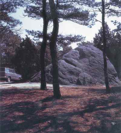 Rock FormationBeach
 Lighthouse
 Lighthouse
 LighthouseBeachBeachBeach
Campgrounds nearby (Recreation.gov)
- Le Count Beach House9.3 km (5.8 mi) · reservable
- Sunrise House9.6 km (5.9 mi) · reservable
- Ocean View House9.7 km (6.0 mi) · reservable
- Bay View House16.7 km (10.4 mi) · reservable
- Highland Beach Suites, Unit 325 km (15 mi) · reservable
FAQ
When is the best time to photograph Coast Guard Beach?
What time is golden hour at Coast Guard Beach?
Where does the sun rise and set at Coast Guard Beach?
Can you see the Milky Way from Coast Guard Beach?
Do you need a permit to photograph at Coast Guard Beach?
How far is Coast Guard Beach from Eastham?
Sources
Location data: Wikidata, National Park Service, USGS GNIS / GeoNames, Wikipedia. Sun, moon and Milky Way times are computed by LWPhoto Atlas for 2026. Climate: NASA POWER. Sky darkness is a population-based estimate (Walker's law), not a measurement. See data sources & licenses.