
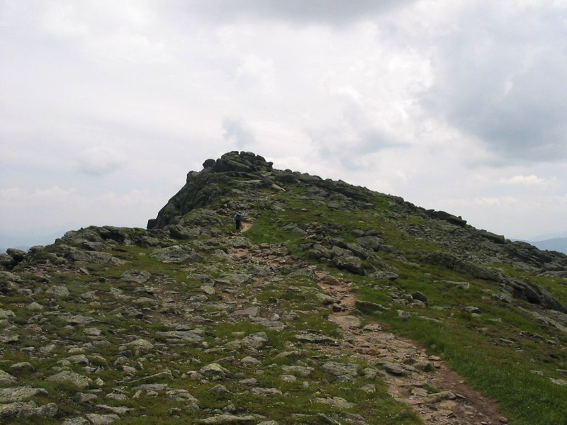
Located in Coos County, New Hampshire, Mount Washington is a mountain peak at about 1,916 m (6,286 ft) above sea level. The nearest town is Gorham, about 16.6 km (10.3 mi) away (Mount Washington lies SW of town).
Mount Washington (Abenaki: Agiocochook) is an ultra-prominent mountain in the state of New Hampshire. It is the highest peak in the Northeastern United States at 6,288.2 ft (1,916.6 m) and the most topographically prominent mountain east of the Mississippi River. The mountain is notorious for its erratic weather. On the afternoon of April 12, 1934, the Mount Washington Observatory recorded a windspeed of 231 mph (372 km/h) at the summit, the world record from 1934 until 1996. Mount Washington still holds the record for the highest measured wind speed not associated with a tornado or tropical cyclone. The mountain is located in the Presidential Range of the White Mountains, in Coös County, New Hampshire. The mountain is in several unincorporated townships, with the summit in the township of Sargent's Purchase. While nearly the whole mountain is in the White Mountain National Forest,...From the Wikipedia article “Mount Washington”, licensed under CC BY-SA 4.0.
Sunrise & sunset directions
At Mount Washington the sunrise point swings a long way through the year: about 55° (NE) at the June solstice and 123° (ESE) in late December. Sunset moves from 305° (NW) in June to 237° (WSW) in December, and the midday sun climbs to 69° in summer but only 22° in winter.
| Date | Sunrise | Azimuth | Sunset | Azimuth | Noon sun | Daylight |
|---|---|---|---|---|---|---|
| March equinox (Mar 20) | 6:49 AM | 90° E | 6:58 PM | 271° W | 46° | 12h 08m |
| June solstice (Jun 21) | 5:02 AM | 55° NE | 8:33 PM | 305° NW | 69° | 15h 31m |
| September equinox (Sep 22) | 6:33 AM | 89° E | 6:45 PM | 271° W | 46° | 12h 12m |
| December solstice (Dec 21) | 7:18 AM | 123° ESE | 4:10 PM | 237° WSW | 22° | 8h 51m |
Azimuth is measured clockwise from true north (90° = east, 270° = west). Computed for 2026; values change by less than a degree from year to year.
Golden hour & blue hour by month
Summits catch first and last light — alpenglow can turn rock pink or orange minutes before sunrise and after sunset while valleys stay in shadow.
| Month (15th) | Blue hour starts | Sunrise | Golden hour ends | Golden hour starts | Sunset | Blue hour ends | Daylight |
|---|---|---|---|---|---|---|---|
| January | 6:46 AM | 7:18 AM | 8:04 AM | 3:46 PM | 4:32 PM | 5:04 PM | 9h 14m |
| February | 6:16 AM | 6:46 AM | 7:27 AM | 4:34 PM | 5:15 PM | 5:44 PM | 10h 29m |
| March | 6:30 AM | 6:59 AM | 7:37 AM | 6:13 PM | 6:51 PM | 7:20 PM | 11h 53m |
| April | 5:32 AM | 6:02 AM | 6:41 AM | 6:50 PM | 7:29 PM | 8:00 PM | 13h 27m |
| May | 4:46 AM | 5:19 AM | 6:01 AM | 7:24 PM | 8:06 PM | 8:39 PM | 14h 46m |
| June | 4:25 AM | 5:02 AM | 5:46 AM | 7:47 PM | 8:31 PM | 9:08 PM | 15h 30m |
| July | 4:41 AM | 5:16 AM | 5:59 AM | 7:44 PM | 8:28 PM | 9:03 PM | 15h 12m |
| August | 5:18 AM | 5:49 AM | 6:29 AM | 7:12 PM | 7:52 PM | 8:23 PM | 14h 03m |
| September | 5:56 AM | 6:25 AM | 7:03 AM | 6:20 PM | 6:58 PM | 7:27 PM | 12h 33m |
| October | 6:31 AM | 7:00 AM | 7:40 AM | 5:23 PM | 6:03 PM | 6:32 PM | 11h 02m |
| November | 6:10 AM | 6:42 AM | 7:25 AM | 3:36 PM | 4:20 PM | 4:51 PM | 9h 38m |
| December | 6:42 AM | 7:15 AM | 8:02 AM | 3:20 PM | 4:08 PM | 4:41 PM | 8h 53m |
Local time (America/New York), including daylight saving time. Golden hour runs from about −4° to +6° solar altitude, so the morning golden hour begins during blue hour, before sunrise.
Milky Way & night sky
From Mount Washington, the Milky Way core is visible in a dark sky from March through September. June gives the longest window (about 3.5 hours on a moonless night), and the core peaks around 17° above the southern horizon. Our light-pollution model puts the sky at about Bortle 3 (rural sky), good enough for detailed Milky Way images.
| Month | Core visible (15th) | Hours | Max altitude | Direction |
|---|---|---|---|---|
| January | Below 10° in darkness | — | -3° | — |
| February | Below 10° in darkness | — | 8° | — |
| March | 4:38 AM – 5:18 AM | 0.7 | 13° | SSE → SSE |
| April | 2:35 AM – 4:05 AM | 1.5 | 16° | SSE → S |
| May | 12:41 AM – 3:11 AM | 2.5 | 17° | SSE → S |
| June | 10:58 PM – 2:28 AM | 3.5 | 17° | SSE → SSW |
| July | 10:43 PM – 1:13 AM | 2.5 | 17° | S → SSW |
| August | 9:44 PM – 11:14 PM | 1.5 | 16° | S → SSW |
| September | 8:37 PM – 9:07 PM | 0.5 | 13° | SSW → SSW |
| October | Below 10° in darkness | — | 8° | — |
| November | Below 10° in darkness | — | -2° | — |
| December | Below 10° in darkness | — | -20° | — |
Window when the galactic core is at least 10° high during astronomical darkness on the 15th of each month. Pick nights within a few days of the new moon. Plan exact nights with the Milky Way planner.
Estimated sky darkness: 3 Bortle 3 — Rural sky. Some light domes sit on the horizon, but the Milky Way still looks complex overhead. Modeled zenith brightness ≈ 21.67 mag/arcsec². Aurora needs roughly Kp 4.5+ to show low on the northern horizon here.
Weather & best season
Long-term NASA satellite data for this area show September as the clearest month (about 56% average cloud cover) and December as the cloudiest (78%). July is the warmest month and January the coldest, which matters for gear, snow access and how long batteries last at night.
Average cloud cover (%)
| Jan | Feb | Mar | Apr | May | Jun | Jul | Aug | Sep | Oct | Nov | Dec | |
|---|---|---|---|---|---|---|---|---|---|---|---|---|
| High °F | 50 | 60 | 70 | 75 | 83 | 87 | 89 | 92 | 83 | 76 | 65 | 55 |
| Low °F | -27 | -32 | -21 | 7 | 24 | 33 | 43 | 41 | 28 | 20 | -4 | -22 |
| Precip. (in) | 2.6 | 3.0 | 3.0 | 3.8 | 4.2 | 5.3 | 4.5 | 4.3 | 3.6 | 5.0 | 3.7 | 3.9 |
Monthly climatology for the surrounding 1° grid cell from NASA POWER (MERRA-2). Mountain sites can be colder and cloudier than the cell average.
Photography tips for this mountain peak
- Clouds around the summit add drama — a clear blue sky is often the least interesting condition.
- Photograph the peak from a lake, meadow or ridge at sunrise when the face that looks east lights up first.
- Long lenses compress ridgelines; shoot the peak from several miles away to make it look massive.
- Afternoon thunderstorms are common in summer at high elevations — plan summit hikes for early morning.
- Snow on the summit holds detail best when you expose for the highlights and lift shadows later.
- Scout in daylight if you plan to shoot at night or before sunrise.
Season: Early summer keeps snow on the peaks with green valleys below; autumn adds aspen or larch color in many ranges.
Suggested gear: Telephoto lens, Lightweight tripod, Warm layers, Microspikes in shoulder seasons. Work out exposures with the depth of field, ND filter and NPF rule calculators.
Nearby photo spots
Other locations within 25 km of Mount Washington, closest first.
 State Park
 Mountain Peak
 Mountain Peak
 Mountain Peak
 Mountain Peak
 Mountain Pass
 Mountain Peak
 Waterfall
 Mountain Peak
Campgrounds nearby (Recreation.gov)
- Dolly Copp Picnic Pavilion9.1 km (5.6 mi) · reservable
- Dolly Copp9.6 km (6.0 mi) · reservable
- Barnes Field Campground10.1 km (6.3 mi) · reservable
- Black Mountain Cabin13.3 km (8.2 mi) · reservable
- Sugarloaf 2 Campground16.1 km (10.0 mi) · reservable
FAQ
When is the best time to photograph Mount Washington?
What time is golden hour at Mount Washington?
Where does the sun rise and set at Mount Washington?
Can you see the Milky Way from Mount Washington?
Do you need a permit to photograph at Mount Washington?
How far is Mount Washington from Gorham?
Sources
Location data: Wikidata, USGS GNIS / GeoNames, Wikipedia. Sun, moon and Milky Way times are computed by LWPhoto Atlas for 2026. Climate: NASA POWER. Sky darkness is a population-based estimate (Walker's law), not a measurement. See data sources & licenses.