Cape Krusenstern National Monument is a National Monument in Alaska. This guide combines the park's official information with computed sunrise, sunset and Milky Way times, satellite climate data and 1 photo locations inside or next to the park.
Best photo spots in Cape Krusenstern
We matched 1 named overlooks, waterfalls, peaks and other features to Cape Krusenstern. Each has its own page with sun directions and a monthly golden hour table.
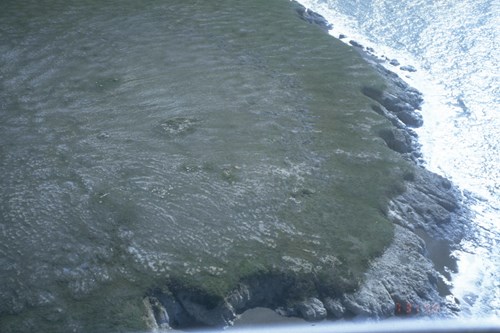
Rock Formations (1)
Sunrise, sunset & golden hour
At this latitude the sun does not rise or set on some days of the year, so check the monthly table below for daylight and twilight.
| Month (15th) | Sunrise | Golden hour ends | Golden hour starts | Sunset | Sunset az. | Daylight |
|---|---|---|---|---|---|---|
| January | 12:13 PM | — | — | 3:55 PM | 206° | 3h 41m |
| February | 10:08 AM | 11:47 AM | 4:31 PM | 6:10 PM | 238° | 8h 01m |
| March | 9:14 AM | 10:27 AM | 7:40 PM | 8:53 PM | 267° | 11h 39m |
| April | 7:06 AM | 8:22 AM | 9:27 PM | 10:43 PM | 299° | 15h 38m |
| May | 4:52 AM | 6:41 AM | 11:01 PM | 12:51 AM | 332° | 19h 59m |
| June | — | 5:44 AM | 12:06 AM | — | — | — |
| July | 3:38 AM | 6:17 AM | 11:44 PM | 2:23 AM | 352° | 22h 45m |
| August | 6:21 AM | 7:45 AM | 10:13 PM | 11:38 PM | 312° | 17h 16m |
| September | 8:13 AM | 9:25 AM | 8:16 PM | 9:27 PM | 280° | 13h 14m |
| October | 9:57 AM | 11:20 AM | 6:01 PM | 7:24 PM | 249° | 9h 28m |
| November | 11:00 AM | — | — | 4:19 PM | 218° | 5h 19m |
| December | 1:24 PM | — | — | 2:16 PM | 186° | 0h 52m |
Computed for the park's reference point (67.4150, -163.5038); large parks span several minutes of difference.
Milky Way & dark skies
The Milky Way's bright core (in Sagittarius) barely clears the southern horizon at this latitude, so focus on winter Milky Way, aurora or star trails instead.
| Month | Core visible (15th) | Hours | Max altitude |
|---|---|---|---|
| January | Not visible in darkness | — | — |
| February | Not visible in darkness | — | — |
| March | Not visible in darkness | — | — |
| April | Not visible in darkness | — | — |
| May | Not visible in darkness | — | — |
| June | Not visible in darkness | — | — |
| July | Not visible in darkness | — | — |
| August | Not visible in darkness | — | — |
| September | Not visible in darkness | — | — |
| October | Not visible in darkness | — | — |
| November | Not visible in darkness | — | — |
| December | Not visible in darkness | — | — |
1 Estimated Bortle 1 — Excellent dark-sky site. The Milky Way casts faint shadows; zodiacal light and airglow are obvious.
Weather & best time to visit
Snow, rain, and freezing temperatures can occur any time of the year. Always travel with good quality rain gear and warm layers. Be especially careful to stay dry. Hypothermia can set in on a windy, wet day, even when it doesn't feel that cold.
Weather overview: National Park Service.
Long-term NASA satellite data for this area show January as the clearest month (about 48% average cloud cover) and October as the cloudiest (70%). July is the warmest month and January the coldest, which matters for gear, snow access and how long batteries last at night.
Average cloud cover (%)
Average high (°F)
Photography permits, drones & fees
Permits. Under federal law (54 U.S.C. 100905), still photography in National Park Service areas needs a permit only when it (1) takes place where members of the public are not allowed, (2) uses models, sets or props that are not part of the location's natural or cultural resources or administrative facilities, or (3) would cause the park to incur additional administrative costs to monitor the activity. Ordinary visitor and most landscape photography needs no permit. Commercial filming rules are separate and have changed in recent years — confirm current requirements with the park before a paid shoot.
Drones. Launching, landing or operating unmanned aircraft (drones) is prohibited in National Park Service units under a 2014 Superintendent's closure (36 CFR 1.5), except where a park has issued specific written approval. Flying from outside the boundary over park land can also violate park rules and disturb wildlife.
Getting there
Cape Krusenstern National Monument lies within a remote area of northwest Alaska and is bordered by the Arctic Ocean and Chukchi Sea. Visitors generally access the monument via the regional hub in Kotzebue. Commercial airlines provide daily service from Anchorage to Kotzebue. Chartered flights with licensed air taxi services, booked in advance, can take backcountry travelers to remote destinations within the monument.
Directions: National Park Service.
Activities
- Camping
- Backcountry Camping
- Flying
- Fixed Wing Flying
- Hands-On
- Arts and Crafts
- Hiking
- Backcountry Hiking
- Junior Ranger Program
- Wildlife Watching
- Birdwatching
- Museum Exhibits
- Shopping
- Bookstore and Park Store