Top natural arches
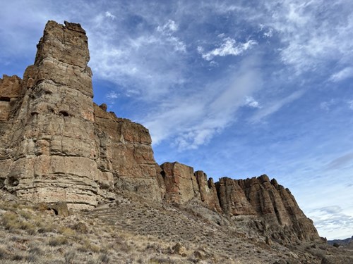 Natural Arch
Arch Trail Introduction
 Natural Arch
Natural Bridges Cove
 Natural Arch
Devils Punchbowl Arch
Natural ArchClaron Arch
Natural ArchCow Horn Arch
Natural ArchHaystack Rock Arch
Natural ArchNatural Bridge
Natural ArchNeedle Rock
Natural ArchPhantom Natural Bridge
Natural ArchRock Bridge
Natural ArchSea Lion Rock Arch
Natural ArchTex Creek Arch
Natural Arches by county
All natural arches (16)
| Name | County | Elevation | Nearest town | Sky |
|---|---|---|---|---|
| Arch Trail IntroductionJohn Day Fossil Beds | Wasco County | — | Madras | 2 |
| Natural Bridges Cove | Curry County | 11 m | Brookings | 2 |
| Devils Punchbowl Arch | Lincoln County | 9 m | Depoe Bay | 4 |
| Claron Arch | Wheeler County | 473 m | Madras | 2 |
| Cow Horn Arch | Douglas County | 1,301 m | Shady Cove | 2 |
| Haystack Rock Arch | Tillamook County | 2 m | Pacific City | 3 |
| Natural Bridge | Jackson County | 977 m | Shady Cove | 2 |
| Needle Rock | Jackson County | 663 m | Shady Cove | 2 |
| Phantom Natural Bridge | Marion County | 1,381 m | Mill City | 3 |
| Rock Bridge | Marion County | 1,312 m | Mill City | 3 |
| Sea Lion Rock Arch | Clatsop County | 11 m | Cannon Beach | 3 |
| Tex Creek Arch | Grant County | 1,368 m | John Day | 1 |
| Biggs Arch | Sherman County | 113 m | Goldendale | 2 |
| Battle Rock Arch | Curry County | — | Port Orford | 1 |
| Twin Rocks Arch | Tillamook County | — | Rockaway Beach | 3 |
| Two Arches | Tillamook County | — | Pacific City | 3 |
Sky = estimated Bortle class (1 darkest – 9 brightest).
Map
How to photograph natural arches
Arches glow when reflected light bounces off nearby rock — the underside of an arch often turns bright orange just after sunrise or before sunset.
- Frame distant features through the opening of the arch for a natural window.
- At night, arches make classic Milky Way foregrounds; low-level lighting or blue hour exposures keep the rock detailed.
- Use a wide lens and get close to emphasize the span against the sky.
- Never climb on arches; many are fragile and climbing is prohibited on park lands.
- Midday sun creates hard shadows, but can light the underside through reflection in narrow canyons.
Season: Spring and autumn offer mild temperatures in desert arch country; summer heat is extreme at midday.