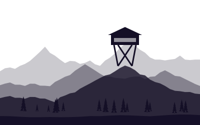
High Rock Lookout is a fire lookout in Pierce County, Washington. It lies in or next to Mount Rainier National Park, so park hours, fees and rules apply. The nearest town is Morton, about 32 km (20 mi) away (High Rock Lookout lies ENE of town).
Wikidata describes it as: “historic fire lookout”.
Sunrise & sunset directions
At High Rock Lookout the sunrise point swings a long way through the year: about 54° (NE) at the June solstice and 125° (SE) in late December. Sunset moves from 307° (NW) in June to 236° (SW) in December, and the midday sun climbs to 67° in summer but only 20° in winter.
| Date | Sunrise | Azimuth | Sunset | Azimuth | Noon sun | Daylight |
|---|---|---|---|---|---|---|
| March equinox (Mar 20) | 7:11 AM | 89° E | 7:20 PM | 271° W | 43° | 12h 09m |
| June solstice (Jun 21) | 5:15 AM | 54° NE | 9:06 PM | 307° NW | 67° | 15h 51m |
| September equinox (Sep 22) | 6:55 AM | 89° E | 7:07 PM | 271° W | 44° | 12h 12m |
| December solstice (Dec 21) | 7:50 AM | 125° SE | 4:23 PM | 236° SW | 20° | 8h 33m |
Azimuth is measured clockwise from true north (90° = east, 270° = west). Computed for 2026; values change by less than a degree from year to year.
Golden hour & blue hour by month
Lookouts are built for 360° views, so sunrise and sunset are both options — use the azimuths to decide which view you want.
| Month (15th) | Blue hour starts | Sunrise | Golden hour ends | Golden hour starts | Sunset | Blue hour ends | Daylight |
|---|---|---|---|---|---|---|---|
| January | 7:15 AM | 7:49 AM | 8:37 AM | 3:58 PM | 4:47 PM | 5:21 PM | 8h 58m |
| February | 6:41 AM | 7:12 AM | 7:55 AM | 4:50 PM | 5:33 PM | 6:04 PM | 10h 20m |
| March | 6:51 AM | 7:21 AM | 8:01 AM | 6:33 PM | 7:13 PM | 7:44 PM | 11h 52m |
| April | 5:49 AM | 6:21 AM | 7:02 AM | 7:15 PM | 7:56 PM | 8:27 PM | 13h 35m |
| May | 4:58 AM | 5:34 AM | 6:18 AM | 7:52 PM | 8:36 PM | 9:11 PM | 15h 01m |
| June | 4:35 AM | 5:14 AM | 6:01 AM | 8:17 PM | 9:04 PM | 9:43 PM | 15h 50m |
| July | 4:52 AM | 5:30 AM | 6:15 AM | 8:13 PM | 8:59 PM | 9:36 PM | 15h 29m |
| August | 5:33 AM | 6:06 AM | 6:48 AM | 7:38 PM | 8:20 PM | 8:53 PM | 14h 13m |
| September | 6:16 AM | 6:46 AM | 7:26 AM | 6:41 PM | 7:21 PM | 7:52 PM | 12h 35m |
| October | 6:55 AM | 7:26 AM | 8:07 AM | 5:41 PM | 6:22 PM | 6:53 PM | 10h 56m |
| November | 6:38 AM | 7:11 AM | 7:57 AM | 3:49 PM | 4:35 PM | 5:08 PM | 9h 24m |
| December | 7:11 AM | 7:46 AM | 8:38 AM | 3:30 PM | 4:21 PM | 4:56 PM | 8h 35m |
Local time (America/Los Angeles), including daylight saving time. Golden hour runs from about −4° to +6° solar altitude, so the morning golden hour begins during blue hour, before sunrise.
Milky Way & night sky
From High Rock Lookout, the Milky Way core is visible in a dark sky from April through August. June gives the longest window (about 2.3 hours on a moonless night), and the core peaks around 14° above the southern horizon. Our light-pollution model puts the sky at about Bortle 3 (rural sky), good enough for detailed Milky Way images.
| Month | Core visible (15th) | Hours | Max altitude | Direction |
|---|---|---|---|---|
| January | Below 10° in darkness | — | -5° | — |
| February | Below 10° in darkness | — | 6° | — |
| March | 5:25 AM – 5:35 AM | 0.2 | 11° | SSE → SSE |
| April | 3:28 AM – 4:18 AM | 0.8 | 13° | SSE → SSE |
| May | 1:34 AM – 3:04 AM | 1.5 | 14° | SSE → S |
| June | 11:56 PM – 2:16 AM | 2.3 | 14° | SSE → SSW |
| July | 11:33 PM – 1:13 AM | 1.7 | 14° | S → SSW |
| August | 10:21 PM – 11:11 PM | 0.8 | 13° | SSW → SSW |
| September | 9:06 PM – 9:06 PM | 0.0 | 10° | SSW → SSW |
| October | Below 10° in darkness | — | 5° | — |
| November | Below 10° in darkness | — | -4° | — |
| December | Below 10° in darkness | — | -20° | — |
Window when the galactic core is at least 10° high during astronomical darkness on the 15th of each month. Pick nights within a few days of the new moon. Plan exact nights with the Milky Way planner.
Estimated sky darkness: 3 Bortle 3 — Rural sky. Some light domes sit on the horizon, but the Milky Way still looks complex overhead. Modeled zenith brightness ≈ 21.4 mag/arcsec². Aurora needs roughly Kp 5.0+ to show low on the northern horizon here.
Weather & best season
Long-term NASA satellite data for this area show July as the clearest month (about 29% average cloud cover) and January as the cloudiest (75%). August is the warmest month and December the coldest, which matters for gear, snow access and how long batteries last at night.
Average cloud cover (%)
| Jan | Feb | Mar | Apr | May | Jun | Jul | Aug | Sep | Oct | Nov | Dec | |
|---|---|---|---|---|---|---|---|---|---|---|---|---|
| High °F | 55 | 54 | 64 | 73 | 82 | 92 | 93 | 94 | 92 | 81 | 59 | 47 |
| Low °F | -12 | -9 | 0 | 14 | 24 | 30 | 34 | 37 | 27 | 14 | -11 | -5 |
| Precip. (in) | 6.2 | 4.4 | 4.7 | 3.1 | 2.5 | 1.7 | 0.5 | 0.7 | 1.6 | 3.9 | 6.1 | 6.7 |
Monthly climatology for the surrounding 1° grid cell from NASA POWER (MERRA-2). Mountain sites can be colder and cloudier than the cell average.
Photography tips for this fire lookout
- Haze from wildfire smoke can turn the sun deep red but reduce visibility; check air quality.
- Access roads may be rough or seasonal.
- Some lookouts can be rented overnight through recreation.gov, which puts you on site for both sunset and sunrise.
- Shoot the tower itself against the Milky Way or star trails on clear, moonless nights.
- Bring a spare battery — cold weather and long exposures drain them fast.
Season: Summer and early autumn; many towers are staffed only during fire season.
Suggested gear: Wide and telephoto lenses, Tripod, Warm layers. Work out exposures with the depth of field, ND filter and NPF rule calculators.
Permits, drones & access
National Park Service rules. Under federal law (54 U.S.C. 100905), still photography in National Park Service areas needs a permit only when it (1) takes place where members of the public are not allowed, (2) uses models, sets or props that are not part of the location's natural or cultural resources or administrative facilities, or (3) would cause the park to incur additional administrative costs to monitor the activity. Ordinary visitor and most landscape photography needs no permit. Commercial filming rules are separate and have changed in recent years — confirm current requirements with the park before a paid shoot.
Drones: Launching, landing or operating unmanned aircraft (drones) is prohibited in National Park Service units under a 2014 Superintendent's closure (36 CFR 1.5), except where a park has issued specific written approval. Flying from outside the boundary over park land can also violate park rules and disturb wildlife.
Nearby photo spots
Other locations within 25 km of High Rock Lookout, closest first.
 National Forest
 Mountain Peak
 Fire Lookout
 Wilderness Area
 Waterfall
 Waterfall
 Mountain Peak
 WaterfallWaterfall
Campgrounds nearby (Recreation.gov)
- Big Creek (Gifford Pinchot National Forest, Wa)7.7 km (4.8 mi) · reservable
- Cougar Rock Campground12.3 km (7.7 mi) · reservable
- Cougar Rock Group Campground12.3 km (7.7 mi) · reservable
- La Wis Wis Campground24 km (15 mi) · reservable
- Ohanapecosh Campground26 km (16 mi) · reservable
FAQ
When is the best time to photograph High Rock Lookout?
What time is golden hour at High Rock Lookout?
Where does the sun rise and set at High Rock Lookout?
Can you see the Milky Way from High Rock Lookout?
Do you need a permit to photograph at High Rock Lookout?
How far is High Rock Lookout from Morton?
Sources
Location data: Wikidata. Sun, moon and Milky Way times are computed by LWPhoto Atlas for 2026. Climate: NASA POWER. Sky darkness is a population-based estimate (Walker's law), not a measurement. See data sources & licenses.