Top mountain passes
 Mountain Pass
Independence Pass
 Mountain Pass
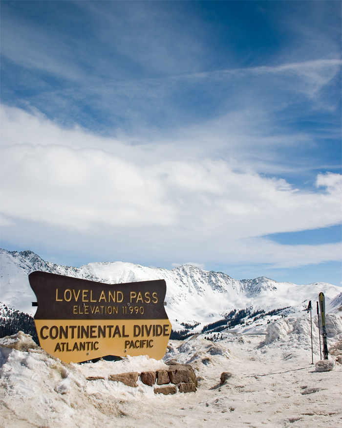
Loveland Pass
 Mountain Pass
Molas Pass
 Mountain Pass
Berthoud Pass
 Mountain Pass
Coal Bank Pass
 Mountain Pass
Wilkerson Pass
 Mountain Pass
Red Mountain Pass
 Mountain Pass
McClure Pass
 Mountain Pass
Ute Pass
 Mountain Pass
Mosca Pass
 Mountain Pass
Rabbit Ears Pass
 Mountain Pass
Trout Creek Pass
Mountain Passes by county
- Boulder County3
- Chaffee County6
- Clear Creek County4
- Grand County9
- Gunnison County7
- Jackson County3
- Larimer County3
- Park County3
- Saguache County5
- San Juan County3
- Summit County7
All mountain passes (84)
| Name | County | Elevation | Nearest town | Sky |
|---|---|---|---|---|
| Independence Pass | Lake County | 3,689 m | Aspen | 2 |
| Loveland Pass | Summit County | 3,656 m | Keystone | 3 |
| Molas Pass | San Juan County | 3,326 m | Telluride | 1 |
| Berthoud Pass | Clear Creek County | 3,452 m | Georgetown | 3 |
| Coal Bank Pass | San Juan County | 3,234 m | Telluride | 1 |
| Wilkerson Pass | Park County | 2,897 m | Woodland Park | 3 |
| Red Mountain Pass | Ouray County | 3,383 m | Telluride | 1 |
| McClure Pass | Gunnison County | 2,680 m | Carbondale | 2 |
| Ute Pass | Teller County | 2,800 m | Woodland Park | 4 |
| Mosca PassGreat Sand Dunes | Alamosa County | 2,968 m | Alamosa East | 2 |
| Rabbit Ears Pass | Jackson County | 2,874 m | Steamboat Springs | 2 |
| Trout Creek Pass | Chaffee County | 2,895 m | Buena Vista | 3 |
| Fall River PassRocky Mountain | Larimer County | 3,585 m | Estes Park | 3 |
| La Poudre PassRocky Mountain | Grand County | 3,104 m | Estes Park | 3 |
| Milner PassRocky Mountain | Grand County | 3,279 m | Estes Park | 3 |
| Monarch Pass | Chaffee County | 3,446 m | Salida | 2 |
| Vail Pass | Summit County | 3,236 m | Frisco | 3 |
| Searle Pass | Summit County | 3,668 m | Breckenridge | 3 |
| Cumberland Pass | Gunnison County | 3,668 m | Buena Vista | 2 |
| Carnero Pass | Saguache County | 3,100 m | Del Norte | 2 |
| Original Monarch Pass | Chaffee County | 3,515 m | Salida | 2 |
| Dunckley Pass | Rio Blanco County | 2,977 m | Hayden | 2 |
| Poncha Pass | Chaffee County | 2,751 m | Salida | 2 |
| Willow Creek Pass | Grand County | 2,944 m | Granby | 3 |
| Wolf Creek Pass | Mineral County | 3,299 m | Pagosa Springs | 1 |
| Douglas Pass | Garfield County | 2,501 m | Loma | 1 |
| Guanella Pass | Clear Creek County | 3,554 m | Georgetown | 4 |
| Hoosier Pass | Summit County | 3,515 m | Breckenridge | 3 |
| Imogene Pass | Ouray County | 3,998 m | Telluride | 1 |
| Lizard Head Pass | San Miguel County | 3,123 m | Mountain Village | 1 |
| Marshall Pass | Saguache County | 3,317 m | Salida | 2 |
| Mosquito Pass | Lake County | 4,017 m | Leadville | 3 |
| Cordova Pass | Las Animas County | 3,432 m | Walsenburg | 1 |
| Cottonwood Pass | Chaffee County | 3,694 m | Buena Vista | 2 |
| Cameron PassRocky Mountain | Larimer County | 3,124 m | Estes Park | 3 |
| Cochetopa Pass | Saguache County | 3,109 m | Gunnison | 2 |
| Hancock Pass | Chaffee County | 3,722 m | Buena Vista | 2 |
| Pass Creek Pass | Costilla County | 2,859 m | Walsenburg | 2 |
| Ripple Creek Pass | Garfield County | 3,157 m | Hayden | 2 |
| Red Hill Pass | Park County | 3,042 m | Breckenridge | 3 |
| Sangre de Cristo Pass | Costilla County | 2,886 m | Walsenburg | 2 |
| Slumgullion Pass | Hinsdale County | 3,462 m | Ouray | 1 |
| Spring Creek Pass | Hinsdale County | 3,319 m | Ouray | 1 |
| Yellowjacket Pass | Archuleta County | 2,373 m | Bayfield | 2 |
| Shrine Pass | Summit County | 3,379 m | Frisco | 3 |
| Buffalo Pass | Routt County | 3,138 m | Steamboat Springs | 3 |
| Gore Pass | Grand County | 2,907 m | Kremmling | 2 |
| Hagerman Pass | Pitkin County | 3,639 m | Leadville North | 2 |
| Kebler Pass | Gunnison County | 3,049 m | Crested Butte | 2 |
| Muddy Pass | Jackson County | 2,627 m | Steamboat Springs | 2 |
| North Pass | Saguache County | 3,051 m | Gunnison | 2 |
| Ohio Pass | Gunnison County | 3,068 m | Crested Butte | 2 |
| Cucharas Pass | Las Animas County | 3,029 m | Walsenburg | 1 |
| Arapaho Pass | Boulder County | 3,629 m | Fraser | 4 |
| Argentine Pass | Clear Creek County | 4,025 m | Georgetown | 3 |
| Tenderfoot Pass | Teller County | — | Cripple Creek | 4 |
| Cerro SummitBlack Canyon Of The Gunnison | Montrose County | — | Montrose | 2 |
| Unaweep Canyon | Mesa County | — | Orchard Mesa | 2 |
| Dallas Divide | San Miguel County | — | Mountain Village | 1 |
| Hardscrabble Pass | Custer County | — | Florence | 3 |
| Monument Hill | El Paso County | — | Woodmoor | 6 |
| Wind River PassRocky Mountain | Larimer County | 2,789 m | Estes Park | 4 |
| Pawnee Pass (Indian Peaks) | Boulder County | 3,823 m | Nederland | 4 |
| Ptarmigan PassRocky Mountain | Grand County | 3,709 m | Estes Park | 3 |
| Rogers Pass (Colorado) | Gilpin County | 3,623 m | Fraser | 4 |
| Stone Man PassRocky Mountain | Grand County | 3,812 m | Estes Park | 3 |
| Stony Pass | San Juan County | 3,838 m | Ouray | 1 |
| Vasquez Pass | Clear Creek County | 3,564 m | Georgetown | 3 |
| Webster Pass (Colorado) | Summit County | 3,686 m | Keystone | 3 |
| Windy Pass (Mineral County, Colorado) | Mineral County | 3,035 m | Pagosa Springs | 1 |
| Coffeepot Pass | Gunnison County | 3,879 m | Crested Butte | 2 |
| Hayden Pass | Saguache County | 3,254 m | Salida | 2 |
| Ptarmigan Pass | Eagle County | 3,588 m | Frisco | 3 |
| Schofield Pass | Gunnison County | 3,268 m | Crested Butte | 2 |
| Boulder-Grand PassRocky Mountain | Grand County | 3,681 m | Estes Park | 3 |
| Georgia Pass | Summit County | 3,535 m | Breckenridge | 3 |
| La Manga Pass | Conejos County | 3,121 m | Chama | 1 |
| Jones Pass (Colorado) | Grand County | 3,796 m | Georgetown | 3 |
| Kokomo Pass | Eagle County | 3,666 m | Breckenridge | 3 |
| Lake Pass | Gunnison County | 3,724 m | Aspen | 2 |
| Currant Creek Pass | Park County | 2,891 m | Cripple Creek | 3 |
| Arapaho Pass | Jackson County | 2,729 m | Steamboat Springs | 2 |
| Buchanan Pass | Grand County | 3,610 m | Nederland | 4 |
| Halfmoon Pass | Boulder County | — | Fraser | 4 |
Sky = estimated Bortle class (1 darkest – 9 brightest).
Map
How to photograph mountain passes
Mountain passes sit above valleys, so they reward sunrise and sunset with layered ridges, valley fog and long shadows.
- Check road status before driving: many high passes close seasonally or after storms.
- Look for the road itself as a leading line — switchbacks from above make strong compositions.
- Weather changes fast at elevation; carry layers even in summer.
- Summit pull-outs often face one direction; use the sun azimuth table to see whether sunrise or sunset suits the view.
- Wildflowers bloom late at pass elevations — often July to early August in the Rockies and Sierra.
Season: Summer and early autumn are the main season; winter visits depend on plowing and avalanche conditions.