Top waterfalls
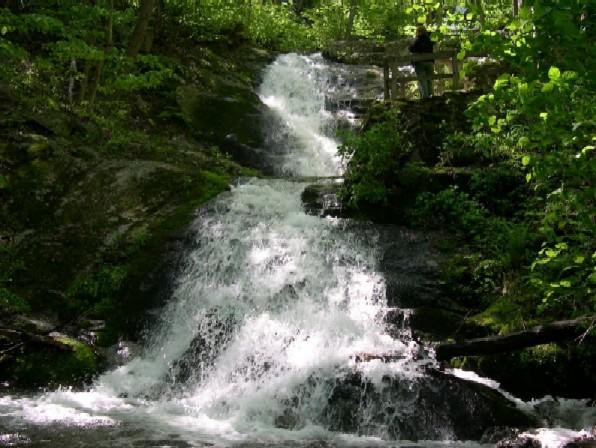 Waterfall
Crabtree Falls
 Waterfall
Dark Hollow Falls
 Waterfall
Falling Springs Falls
WaterfallFallingwater Cascades
WaterfallAbrams Falls
WaterfallApple Orchard Falls
WaterfallBeaverdam Falls
WaterfallBig Falls
WaterfallBig Falls
WaterfallBig Falls
WaterfallBig Rock Falls
WaterfallBlue Suck Falls
Waterfalls by county
All waterfalls (44)
| Name | County | Elevation | Nearest town | Sky |
|---|---|---|---|---|
| Crabtree Falls | Nelson County | 818 m | Nellysford | 3 |
| Dark Hollow FallsShenandoah | Madison County | 902 m | Stanley | 3 |
| Falling Springs Falls | Alleghany County | — | Covington | 3 |
| Fallingwater Cascades | Botetourt County | — | Buchanan | 3 |
| Abrams Falls | Washington County | 503 m | Bristol | 4 |
| Apple Orchard Falls | Botetourt County | 751 m | Buchanan | 3 |
| Beaverdam Falls | Alleghany County | 548 m | White Sulphur Springs | 3 |
| Big Falls | Albemarle County | 588 m | Grottoes | 3 |
| Big Falls | Montgomery County | 500 m | Pembroke | 4 |
| Big Falls | Russell County | 506 m | Lebanon | 3 |
| Big Rock FallsShenandoah | Madison County | 815 m | Stanley | 3 |
| Blue Suck Falls | Bath County | 614 m | Clifton Forge | 3 |
| Cascades | Giles County | 863 m | Pembroke | 3 |
| Cedar FallsShenandoah | Rockingham County | 613 m | Elkton | 3 |
| Falls of Dismal | Giles County | 680 m | Narrows | 3 |
| Dry Run FallsShenandoah | Rockingham County | 712 m | Elkton | 3 |
| Eagle Point Falls (historical) | Mecklenburg County | 91 m | Clarksville | 3 |
| Falling Rock Falls | Franklin County | 258 m | Vinton | 5 |
| Falling Spring Falls | Alleghany County | 626 m | Covington | 3 |
| The Falls | Grayson County | 906 m | Galax | 3 |
| The Falls | Nelson County | 385 m | Nellysford | 3 |
| Gibbs Falls | Rockbridge County | 482 m | East Lexington | 3 |
| Glenn Falls | Rockbridge County | 444 m | Stuarts Draft | 3 |
| Goods Falls | Page County | 190 m | Luray | 4 |
| Greasy Falls | Warren County | 509 m | Front Royal | 4 |
| Great Falls of Dan | Patrick County | 608 m | Stuart | 3 |
| Hyco Falls (historical) | Halifax County | 91 m | South Boston | 3 |
| Jones Run Falls | Albemarle County | 572 m | Grottoes | 3 |
| Lewis Spring FallsShenandoah | Page County | 861 m | Stanley | 3 |
| Meadow Creek Falls | Craig County | 529 m | Daleville | 3 |
| Monkey Falls | Scott County | 376 m | Weber City | 5 |
| Mountain Falls | Frederick County | 360 m | Shawnee Land | 4 |
| Panther Falls | Amherst County | 364 m | Buena Vista | 4 |
| Rose River FallsShenandoah | Madison County | 722 m | Stanley | 3 |
| Smith River Falls | Patrick County | 799 m | Stuart | 3 |
| South River FallsShenandoah | Greene County | 651 m | Elkton | 3 |
| Statons Creek Falls | Amherst County | 555 m | Buena Vista | 3 |
| Styles Falls | Floyd County | 551 m | Shawsville | 4 |
| Tank Hollow Falls | Russell County | 485 m | Lebanon | 3 |
| Upper Falls | Giles County | 910 m | Pembroke | 3 |
| White Falls | Patrick County | 308 m | Ferrum | 3 |
| Wylie Falls | Giles County | 446 m | Narrows | 3 |
| Climbing Rose FallsShenandoah | Madison County | 443 m | Stanley | 3 |
| Miller Falls | Warren County | 757 m | Front Royal | 4 |
Sky = estimated Bortle class (1 darkest – 9 brightest).
Map
How to photograph waterfalls
Waterfalls photograph best in soft, even light: overcast days, deep shade, or the hour after sunrise before direct sun hits the water. Bright sun on white water blows highlights and adds harsh contrast.
- Use 1/4 to 1 second for a silky look; 1/500 s or faster freezes individual drops.
- A circular polarizer cuts glare on wet rocks and leaves and deepens greens — rotate it while watching the rocks, not the sky.
- Spring snowmelt and the days after heavy rain give the strongest flow; late summer flow can drop to a trickle.
- Look for a foreground: a mossy boulder, a fallen log or the creek's leading lines make a stronger frame than the falls alone.
- Keep a microfiber cloth handy — spray drifts onto the lens, especially at the plunge pool.
Season: Peak flow is usually in late spring; autumn adds color around the falls, and winter can bring ice formations at colder locations.