Top waterfalls
 Waterfall
Gibbon Falls
 Waterfall
Kepler Cascades
 Waterfall
Lewis Falls
 Waterfall
Yellowstone Falls
 Waterfall
Mystic Falls
 Waterfall
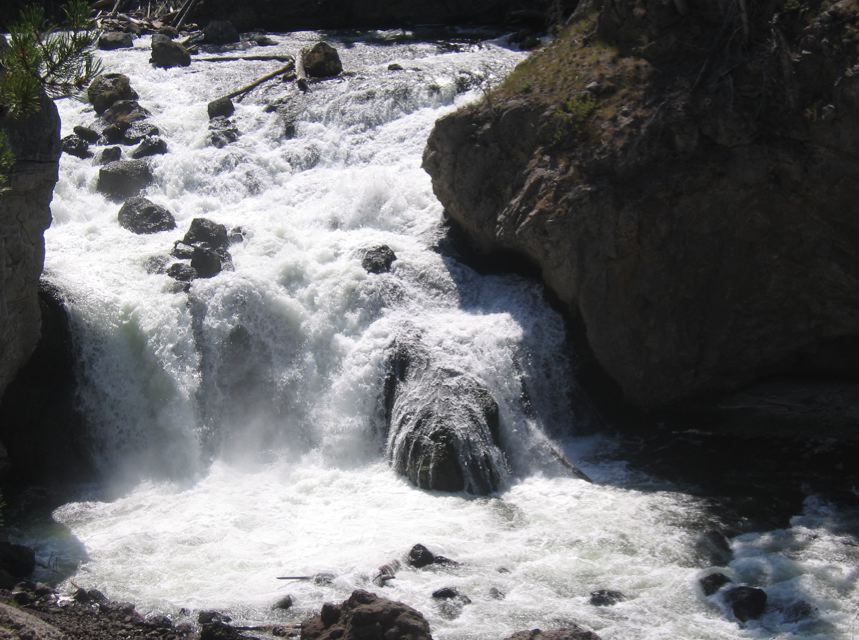
Firehole Falls
 Waterfall
Virginia Cascades
 Waterfall
Union Falls
 Waterfall
Tower Fall
 Waterfall
Shell Falls
 Waterfall
Bechler Falls
 Waterfall
Terraced Falls
Waterfalls by county
- Big Horn County4
- Converse County3
- Fremont County6
- Lincoln County3
- Park County17
- Sublette County8
- Teton County47
All waterfalls (91)
| Name | County | Elevation | Nearest town | Sky |
|---|---|---|---|---|
| Gibbon FallsYellowstone | Teton County | 2,159 m | West Yellowstone | 1 |
| Kepler CascadesYellowstone | Teton County | 2,304 m | West Yellowstone | 1 |
| Lewis FallsYellowstone | Teton County | 2,355 m | West Yellowstone | 1 |
| Yellowstone FallsYellowstone | Park County | — | West Yellowstone | 1 |
| Mystic FallsYellowstone | Teton County | 2,280 m | West Yellowstone | 1 |
| Firehole FallsYellowstone | Teton County | 2,100 m | West Yellowstone | 1 |
| Virginia CascadesYellowstone | Park County | 2,382 m | West Yellowstone | 1 |
| Union FallsYellowstone | Teton County | 2,070 m | Ashton | 1 |
| Tower FallYellowstone | Park County | 1,929 m | Livingston | 1 |
| Shell Falls | Big Horn County | 1,909 m | Greybull | 1 |
| Bechler FallsYellowstone | Teton County | 1,933 m | Ashton | 1 |
| Terraced FallsYellowstone | Teton County | 2,102 m | Ashton | 1 |
| Iris FallsYellowstone | Teton County | 2,032 m | Ashton | 1 |
| Hidden FallsGrand Teton | Teton County | 2,278 m | Moose Wilson Road | 1 |
| Shoshoko FallsGrand Teton | Teton County | 2,736 m | Moose Wilson Road | 1 |
| Colonnade FallsYellowstone | Teton County | 1,994 m | Ashton | 1 |
| Osprey FallsYellowstone | Park County | 2,001 m | West Yellowstone | 1 |
| Moose FallsYellowstone | Teton County | 2,126 m | Driggs | 1 |
| Silver Cord CascadeYellowstone | Park County | 2,396 m | West Yellowstone | 1 |
| Broken FallsGrand Teton | Teton County | 2,434 m | Moose Wilson Road | 1 |
| Upper Falls of the Yellowstone RiverYellowstone | Park County | 2,322 m | West Yellowstone | 1 |
| Bannock FallsGrand Teton | Teton County | 2,373 m | Moose Wilson Road | 1 |
| Cleft FallsGrand Teton | Teton County | 2,625 m | Moose Wilson Road | 1 |
| Columbine CascadeGrand Teton | Teton County | 2,569 m | Driggs | 1 |
| Glacier FallsGrand Teton | Teton County | 2,335 m | Moose Wilson Road | 1 |
| Ribbon CascadeGrand Teton | Teton County | 2,309 m | Moose Wilson Road | 1 |
| Spalding FallsGrand Teton | Teton County | 3,049 m | Moose Wilson Road | 1 |
| Wilderness FallsGrand Teton | Teton County | 2,856 m | Driggs | 1 |
| Crystal FallsYellowstone | Park County | 2,350 m | West Yellowstone | 1 |
| Lower Falls of the Yellowstone RiverYellowstone | Park County | 2,270 m | West Yellowstone | 1 |
| Rustic Falls | Park County | 2,198 m | West Yellowstone | 1 |
| Cascades of the FireholeYellowstone | Teton County | 2,165 m | West Yellowstone | 1 |
| Undine Falls | Park County | 1,980 m | West Yellowstone | 1 |
| Popo Agie Falls | Fremont County | 2,357 m | Lander | 2 |
| Brink of Upper Falls Comfort StationYellowstone | Park County | — | West Yellowstone | 1 |
| Cascade Canyon TurnoutGrand Teton | Teton County | — | Moose Wilson Road | 1 |
| Albright Falls | Teton County | 2,276 m | West Yellowstone | 1 |
| Beartooth Falls | Park County | 2,670 m | Red Lodge | 1 |
| Big Creek Falls | Park County | 2,973 m | Cody | 1 |
| Bomber Falls | Fremont County | 2,747 m | Lander | 1 |
| Bridal Veil Falls | Park County | 1,633 m | Red Lodge | 1 |
| Brooks Lake Creek Falls | Fremont County | 2,522 m | Jackson | 1 |
| Bucking Mule Falls | Big Horn County | 2,311 m | Lovell | 1 |
| Bull Lake Falls | Fremont County | 1,787 m | Fort Washakie | 1 |
| Cascade Acres | Teton County | 2,123 m | Ashton | 1 |
| Cave Falls | Teton County | 1,915 m | Ashton | 1 |
| Clear Creek Falls | Sublette County | 2,449 m | Pinedale | 1 |
| Cliff Creek Falls | Sublette County | 2,523 m | Hoback | 1 |
| Cottonwood Falls | Platte County | 1,675 m | Wheatland | 1 |
| Duck Creek Falls | Albany County | 1,989 m | Wheatland | 1 |
| Dunanda Falls | Teton County | 2,007 m | Ashton | 1 |
| Fairy Falls | Teton County | 2,334 m | West Yellowstone | 1 |
| Fern Cascades | Teton County | 2,302 m | West Yellowstone | 1 |
| Garden Creek Waterfall | Natrona County | 1,961 m | Mills | 4 |
| Granite Falls | Teton County | 2,099 m | Jackson | 1 |
| Gwinna Falls | Teton County | 2,287 m | West Yellowstone | 1 |
| Lake Fork Falls | Fremont County | 2,807 m | Jackson | 1 |
| Le Vasseur Falls | Converse County | 1,915 m | Glenrock | 2 |
| Lewis Falls | Lincoln County | 2,760 m | Afton | 1 |
| Little Medicine Falls | Converse County | 2,366 m | Glenrock | 1 |
| Lost Creek Falls | Park County | 2,024 m | Livingston | 1 |
| Melody Falls | Big Horn County | 1,760 m | Lovell | 1 |
| Menace Falls | Sublette County | 2,866 m | Afton | 1 |
| North Fork Falls | Sublette County | 2,623 m | Pinedale | 1 |
| North Fork Falls | Teton County | 2,505 m | Jackson | 1 |
| Ouzel Falls | Teton County | 2,578 m | Jackson | 1 |
| Ouzel Falls | Teton County | 2,028 m | Ashton | 1 |
| Plateau Falls | Teton County | 2,730 m | Jackson | 1 |
| Porcupine Creek Falls | Sublette County | 2,522 m | Pinedale | 1 |
| Porcupine Falls | Big Horn County | 2,445 m | Lovell | 1 |
| Quiver Cascade | Teton County | 2,391 m | West Yellowstone | 1 |
| Ragged Falls | Teton County | 2,242 m | West Yellowstone | 1 |
| Rainbow Falls | Teton County | 2,059 m | Ashton | 1 |
| Shoal Falls | Teton County | 2,519 m | Hoback | 1 |
| Silver Scarf Falls | Teton County | 2,021 m | Ashton | 1 |
| Slide Creek Falls | Sublette County | 2,691 m | Pinedale | 1 |
| Slide Falls | Sublette County | 2,774 m | Pinedale | 1 |
| Sluiceway Falls | Teton County | 2,307 m | West Yellowstone | 1 |
| South Fork Falls | Teton County | 2,356 m | Jackson | 1 |
| Spring Creek Falls | Lincoln County | 2,563 m | Afton | 1 |
| Sweetwater Creek Falls | Park County | 2,541 m | Cody | 1 |
| Tempe Cascade | Teton County | 2,414 m | West Yellowstone | 1 |
| Tendoy Falls | Teton County | 2,269 m | West Yellowstone | 1 |
| Twilight Falls | Fremont County | 2,729 m | Jackson | 1 |
| Twister Falls | Teton County | 2,455 m | West Yellowstone | 1 |
| Upper Falls | Teton County | 2,668 m | Jackson | 1 |
| Wagon Hound Falls | Converse County | 2,030 m | Douglas | 1 |
| Wahhi Falls | Teton County | 2,341 m | West Yellowstone | 1 |
| West Dell Falls | Sublette County | 2,636 m | Hoback | 1 |
| Wohelo Falls | Lincoln County | 2,771 m | Afton | 1 |
| Wraith Falls | Park County | 2,060 m | West Yellowstone | 1 |
Sky = estimated Bortle class (1 darkest – 9 brightest).
Map
How to photograph waterfalls
Waterfalls photograph best in soft, even light: overcast days, deep shade, or the hour after sunrise before direct sun hits the water. Bright sun on white water blows highlights and adds harsh contrast.
- Use 1/4 to 1 second for a silky look; 1/500 s or faster freezes individual drops.
- A circular polarizer cuts glare on wet rocks and leaves and deepens greens — rotate it while watching the rocks, not the sky.
- Spring snowmelt and the days after heavy rain give the strongest flow; late summer flow can drop to a trickle.
- Look for a foreground: a mossy boulder, a fallen log or the creek's leading lines make a stronger frame than the falls alone.
- Keep a microfiber cloth handy — spray drifts onto the lens, especially at the plunge pool.
Season: Peak flow is usually in late spring; autumn adds color around the falls, and winter can bring ice formations at colder locations.