
Top canyons
 Canyon
The Narrows
 Canyon
Bluejohn Canyon
 Canyon
Zion Canyon
 Canyon
American Fork Canyon
 Canyon
Horseshoe Canyon
 Canyon
Fantasy Canyon
 Canyon
Ninemile Canyon
 Canyon
Big Cottonwood Canyon
 Canyon
Box Elder Canyon
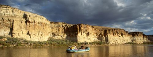 Canyon
Desolation Canyon
 Canyon
Fiery Furnace
 Canyon
Logan Canyon
Canyons by county
All canyons (57)
| Name | County | Elevation | Nearest town | Sky |
|---|---|---|---|---|
| The NarrowsZion | Washington County | — | Toquerville | 2 |
| Bluejohn CanyonCanyonlands | Wayne County | — | Moab | 1 |
| Zion CanyonZion | Washington County | — | Hildale | 2 |
| American Fork CanyonTimpanogos Cave | Utah County | — | Cedar Hills | 7 |
| Horseshoe CanyonCanyonlands | Grand County | — | Moab | 1 |
| Fantasy Canyon | Uintah County | — | Naples | 1 |
| Ninemile Canyon | Carbon County | — | East Carbon City | 2 |
| Big Cottonwood Canyon | Salt Lake County | — | Mount Olympus | 5 |
| Box Elder Canyon | Box Elder County | — | Brigham City | 6 |
| Desolation Canyon | Emery County | — | East Carbon City | 1 |
| Fiery FurnaceArches | Grand County | — | Moab | 1 |
| Logan Canyon | Cache County | — | North Logan | 4 |
| Provo Canyon | Utah County | — | Orem | 6 |
| Butterfield Canyon | Salt Lake County | — | Herriman | 6 |
| Stillwater CanyonCanyonlands | Grand County | — | Moab | 1 |
| Horse Canyon | Garfield County | — | Page | 1 |
| Kings Canyon | Millard County | — | Richfield | 1 |
| Little Cottonwood Canyon | Salt Lake County | — | Granite | 6 |
| Death Hollow | Garfield County | — | Page | 1 |
| Marysvale Canyon | Sevier County | — | Monroe | 1 |
| Mill Creek Canyon | Salt Lake County | — | Mount Olympus | 7 |
| Ogden Canyon | Weber County | — | Liberty | 5 |
| The SubwayZion | Washington County | — | Toquerville | 2 |
| Weber Canyon | Weber County | — | Uintah | 6 |
| White Canyon | San Juan County | — | Moab | 1 |
| Grandstaff CanyonArches | Grand County | — | Moab | 4 |
| Maple Canyon | Sanpete County | — | Moroni | 3 |
| Rock Canyon | Utah County | — | Provo | 6 |
| Cataract CanyonGlen Canyon | San Juan County | — | Moab | 1 |
| Soldier Hollow | Wasatch County | — | Midway | 5 |
| Agua CanyonBryce Canyon | Garfield County | — | Panguitch | 1 |
| Big Spring Canyon to Elephant Canyon Loop TrailCanyonlands | San Juan County | — | Monticello | 1 |
| Big Spring Canyon to Wooden Shoe Canyon Loop TrailCanyonlands | San Juan County | — | Monticello | 1 |
| Black Birch CanyonBryce Canyon | Garfield County | — | Panguitch | 1 |
| Box Canyon TrailDinosaur | Uintah County | — | Naples | 2 |
| Bryce Canyon Shared Use PathBryce Canyon | Garfield County | — | Panguitch | 1 |
| Bryce Canyon Shuttle StationBryce Canyon | Garfield County | — | Panguitch | 1 |
| Canyon JunctionZion | Washington County | — | Hildale | 2 |
| Harker Canyon | Tooele County | — | Eagle Mountain | 3 |
| Crystal Canyon | Juab County | — | Mona | 3 |
| Daves HollowBryce Canyon | Garfield County | — | Panguitch | 1 |
| Dead Ox Canyon | Morgan County | — | Summit Park | 4 |
| Dell Lott Hollow | Sevier County | — | Monroe | 2 |
| Johnson Canyon | Juab County | — | Grantsville | 1 |
| Robbers Roost | Wayne County | — | Moab | 1 |
| Cottonwood Canyon | Kane County | — | Page | 1 |
| Harkers Canyon | Tooele County | — | Tooele | 5 |
| Harkers Canyon | Salt Lake County | — | Magna | 7 |
| Wolverine Canyon | Garfield County | — | Page | 1 |
| Westwater Canyon | Grand County | — | Loma | 1 |
| Recapture Canyon | San Juan County | — | Blanding | 3 |
| Padre Canyon | Washington County | — | Ivins | 5 |
| Curry Canyon | Emery County | — | East Carbon City | 1 |
| Days Canyon | Utah County | — | Springville | 7 |
| Buck Canyon: Tracks in the CanyonCanyonlands | Grand County | — | Moab | 1 |
| Kolob Canyons - Zion Natural ParkZion | Washington County | 1,676 m | Toquerville | 2 |
| Hobble Creek Canyon | Utah County | 1,523 m | Mapleton | 5 |
Sky = estimated Bortle class (1 darkest – 9 brightest).
Map
How to photograph canyons
Canyons need light from above: rims glow at sunrise and sunset, while deep or narrow sections are brightest near midday when reflected light bounces off the walls.
- From the rim, sunrise and sunset side-light reveals layers; a telephoto picks out buttes and shadows.
- In narrow canyons, reflected light creates orange and purple glows; avoid including bright sky in the frame.
- Check flash flood forecasts before entering slot or narrow canyons — rain miles away can flood them.
- Dust and sand are hard on gear; change lenses in a bag or with your back to the wind.
- A long lens on a tripod handles the low light inside canyons better than raising ISO.
Season: Spring and autumn are comfortable; summer monsoon storms bring dramatic skies but higher flood risk in the Southwest.