Top national forests
 National Forest
Boise National Forest
 National Forest
Caribou–Targhee National Forest
 National Forest
Sawtooth National Forest
 National Forest
Kaniksu National Forest
 National Forest
Salmon–Challis National Forest
 National Forest
Clearwater National Forest
 National Forest
Nez Perce National Forest
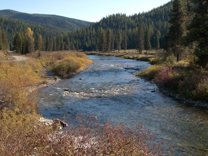 National Forest
St. Joe National Forest
 National Forest
Payette National Forest
 National Forest
Coeur d'Alene National Forest
 National Forest
Minidoka National Forest
National ForestRaft River National Forest
National Forests by county
All national forests (16)
| Name | County | Elevation | Nearest town | Sky |
|---|---|---|---|---|
| Boise National Forest | Boise County | — | Boise | 2 |
| Caribou–Targhee National Forest | Caribou County | — | Conda | 4 |
| Sawtooth National Forest | Blaine County | — | Ketchum | 1 |
| Kaniksu National Forest | Bonner County | — | Ponderay | 2 |
| Salmon–Challis National Forest | Lemhi County | — | Salmon | 1 |
| Clearwater National Forest | Clearwater County | — | Orchard Homes | 1 |
| Nez Perce National Forest | Idaho County | — | Grangeville | 1 |
| St. Joe National Forest | Shoshone County | — | Osburn | 1 |
| Payette National Forest | Valley County | — | McCall | 4 |
| Coeur d'Alene National Forest | Shoshone County | — | Pinehurst | 2 |
| Minidoka National Forest | Cassia County | — | Hansen | 2 |
| Raft River National Forest | Elmore County | — | Ketchum | 1 |
| Selway National Forest | Idaho County | — | Orchard Homes | 1 |
| Cassia National Forest | Cassia County | — | Hansen | 2 |
| Salmon National Forest | Lemhi County | — | Salmon | 1 |
| Nez Perce–Clearwater National Forests | Idaho County | — | Orchard Homes | 1 |
Sky = estimated Bortle class (1 darkest – 9 brightest).
Map
How to photograph national forests
Forests suit soft light — overcast days reduce contrast under the canopy, and morning fog adds depth.
- Dispersed camping is often allowed, which makes sunrise and night shoots easier — check local rules.
- Forest roads can close in winter or after storms; download offline maps.
- Fire restrictions may limit campfires and stoves in summer.
- Look for fire lookouts and high roads for views over the canopy.
- Fall color peaks vary by elevation; follow it downhill over several weeks.
Season: Autumn color and spring flowers draw photographers; winter brings snow-covered forests in the North and West.