Top scenic viewpoints
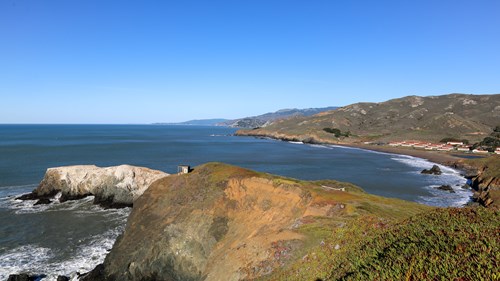 Scenic Viewpoint
Bird Island Overlook
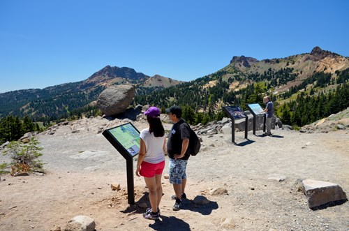 Scenic Viewpoint
Brokeoff Volcano Vista
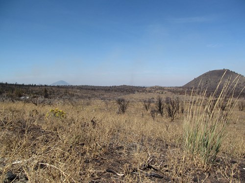 Scenic Viewpoint
Bunchgrass Overlook
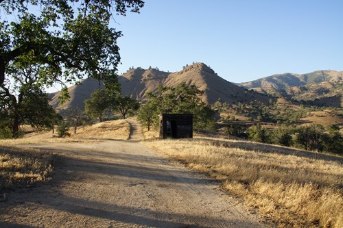 Scenic Viewpoint
Cesar's Vista Point
 Scenic Viewpoint
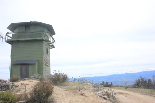
Chalone Peak Fire Lookout
 Scenic Viewpoint
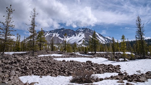
Chaos Crags Viewpoint
 Scenic Viewpoint
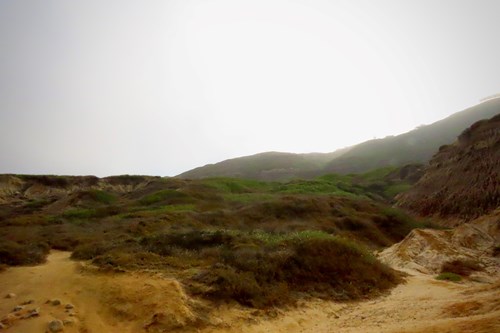
Chaparral View Between Coastal Trail Staircases
 Scenic Viewpoint
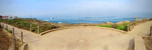
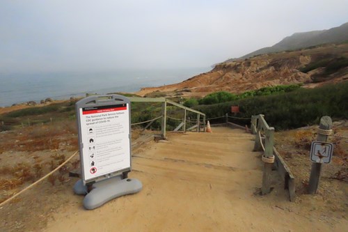
Coastal Trail Southern Clearing View
 Scenic Viewpoint
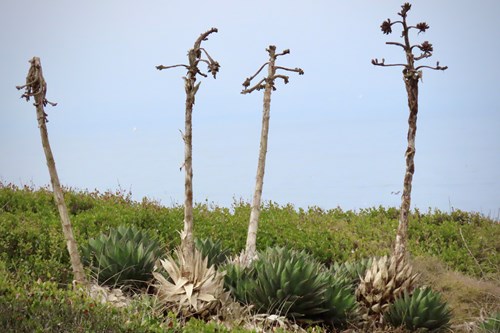
Coastal Trail View of Shaw’s Agave Patch
 Scenic Viewpoint
Coastal Trail View of the Kelp Forest
 Scenic Viewpoint
1 - Introduction: Lands End Lookout
Scenic Viewpoint4 - An Intimate View of Coastal California
Scenic Viewpoints by county
- City and County of San Francisco3
- Fresno County4
- Humboldt County3
- Imperial County4
- Inyo County3
- Los Angeles County4
- Marin County6
- San Diego County9
- Santa Cruz County4
- Shasta County3
- Tulare County4
- Tuolumne County5
All scenic viewpoints (87)
| Name | County | Elevation | Nearest town | Sky |
|---|---|---|---|---|
| Bird Island OverlookGolden Gate | Marin County | 64 m | Marin City | 7 |
| Brokeoff Volcano VistaLassen Volcanic | Shasta County | — | Chester | 2 |
| Bunchgrass OverlookLava Beds | Siskiyou County | — | Altamont | 1 |
| Cesar's Vista PointCésar E. Chávez | Kern County | — | Bear Valley Springs | 4 |
| Chalone Peak Fire LookoutPinnacles | Monterey County | — | Soledad | 4 |
| Chaos Crags ViewpointLassen Volcanic | Shasta County | — | Shingletown | 2 |
| Chaparral View Between Coastal Trail StaircasesCabrillo | San Diego County | — | Coronado | 7 |
| Coastal Trail Southern Clearing ViewCabrillo | San Diego County | — | Coronado | 7 |
| Coastal Trail View of Shaw’s Agave PatchCabrillo | San Diego County | — | Coronado | 7 |
| Coastal Trail View of the Kelp ForestCabrillo | San Diego County | — | Coronado | 7 |
| 1 - Introduction: Lands End LookoutGolden Gate | City and County of San Francisco | — | Parkside | 7 |
| 4 - An Intimate View of Coastal CaliforniaGolden Gate | Marin County | — | Tamalpais Valley | 7 |
| Battery Spencer OverlookGolden Gate | Marin County | — | Sausalito | 7 |
| Bluff Lookout: Mantle Rocks ExposedGolden Gate | City and County of San Francisco | — | San Francisco | 8 |
| Boulders Viewpoint AreaMojave | San Bernardino County | — | Twentynine Palms | 3 |
| Canyon View OverlookSequoia & Kings Canyon | Fresno County | — | Three Rivers | 2 |
| Upper Dock | Imperial County | — | Yuma | 3 |
| River View | Imperial County | — | Yuma | 3 |
| Donald Duck Overlook | Imperial County | — | Yuma | 3 |
| Audubon Overlook | San Luis Obispo County | 7 m | Los Osos | 6 |
| Big Horn Overlook | Riverside County | 1,183 m | La Quinta | 5 |
| Brooks Falls Overlook Trail | San Mateo County | 95 m | Pacifica | 7 |
| Brush Creek Overlook | Tulare County | 2,456 m | Kernville | 3 |
| Carson Pass Scenic Viewpoint | Alpine County | 2,596 m | South Lake Tahoe | 3 |
| Chaparral OverlookPinnacles | San Benito County | 441 m | Soledad | 4 |
| Cottonwood Overlook Trail | Sierra County | 1,792 m | Truckee | 3 |
| Dardanelles Overlook | Calaveras County | 1,496 m | Arnold | 4 |
| Davenport Overlook | Santa Cruz County | 34 m | Bonny Doon | 5 |
| Deadman Flat Scenic Viewpoint | Tuolumne County | 2,070 m | Topaz Ranch Estates | 3 |
| Donnell Vista Point | Tuolumne County | 1,920 m | Arnold | 3 |
| East Flange Scenic Viewpoint | Tuolumne County | 2,158 m | Topaz Ranch Estates | 3 |
| Elk Mountain Scenic Viewpoint | Lake County | 1,058 m | Upper Lake | 3 |
| Emerald Bay Overlook | El Dorado County | 2,018 m | South Lake Tahoe | 4 |
| Emigrant Gap Scenic Viewpoint | Placer County | 1,651 m | Nevada City | 3 |
| Encinitas Viewpoint Park | San Diego County | 44 m | Encinitas | 7 |
| Fairview Point Scenic Viewpoint | Riverside County | 2,338 m | Cabazon | 5 |
| Father Crowley Viewpoint | Inyo County | 1,281 m | Lone Pine | 2 |
| Frazier Falls Scenic Viewpoint | Plumas County | 1,815 m | Portola | 3 |
| Freeman Overlook | Los Angeles County | 1,290 m | Lebec | 4 |
| George C Hoberg Vista Point | Lake County | 429 m | Lakeport | 5 |
| Grant Lake Overlook | Mono County | 2,354 m | Mammoth Lakes | 2 |
| Heath Falls Overlook Trail | Placer County | 1,624 m | Truckee | 3 |
| Junction Vista Point | Fresno County | 1,201 m | Yokuts Valley | 3 |
| Ken Sampson Overlook | Orange County | 42 m | Dana Point | 7 |
| Kenyon Overlook Trail | San Diego County | 589 m | Borrego Springs | 4 |
| Kings Canyon Overlook | Tulare County | 2,183 m | Three Rivers | 3 |
| Liberty Vista Point | Calaveras County | 2,069 m | Arnold | 3 |
| Lookout Point | Tuolumne County | 2,174 m | Twain Harte | 3 |
| Lookout Point Park | Los Angeles County | 76 m | San Pedro | 8 |
| Lookout Point Ranger Station | Tulare County | 1,207 m | Three Rivers | 3 |
| McGee Vista Point | Fresno County | 2,070 m | Yokuts Valley | 3 |
| Mescal Bajada Overlook | San Diego County | 451 m | Borrego Springs | 4 |
| Mount McAbee Overlook | Santa Cruz County | 537 m | Boulder Creek | 5 |
| Muir Beach OverlookGolden Gate | Marin County | 142 m | Tamalpais Valley | 6 |
| Nimbus Dam Overlook | Sacramento County | 78 m | Gold River | 7 |
| Opal Cliffs Drive Overlook | Santa Cruz County | 14 m | Capitola | 7 |
| Overlook Park | Solano County | 101 m | Benicia | 7 |
| Overlook Trail | Monterey County | 5 m | Big Sur | 3 |
| Peddler Hill Scenic Viewpoint | Amador County | 2,051 m | Buckhorn | 3 |
| Red Rock Wall Overlook | San Bernardino County | 1,595 m | Crestline | 6 |
| Redwood Mountain Overlook | Tulare County | 2,086 m | Yokuts Valley | 3 |
| Romero Overlook | Merced County | 187 m | Gustine | 4 |
| San Ramon Valley Overlook | Contra Costa County | 448 m | Blackhawk | 7 |
| Sand Point Overlook | Santa Cruz County | 541 m | Day Valley | 5 |
| Sea Lion Overlook | Marin County | 183 m | Inverness | 4 |
| Shot Rock Vista Scenic Viewpoint | Amador County | 2,318 m | Buckhorn | 3 |
| Taylor Lake Overlook | Imperial County | 63 m | Yuma | 3 |
| Vista Point | Los Angeles County | 1,491 m | Acton | 6 |
| Vista Point | Marin County | 1 m | Sausalito | 8 |
| White Bark Vista Point | Fresno County | 2,929 m | Mammoth Lakes | 2 |
| East Wildlife OverlookTule Lake | Modoc County | 1,246 m | Altamont | 1 |
| Lookout Point | Humboldt County | 1 m | Westhaven-Moonstone | 2 |
| Lookout Point | Shasta County | 964 m | Shasta Lake | 2 |
| Lookout Point Trail | Humboldt County | 235 m | Redway | 1 |
| Mount Vida Vista Scene Viewpoint | Modoc County | 2,003 m | Lakeview | 1 |
| Vista Point | Humboldt County | 44 m | McKinleyville | 5 |
| West Wildlife Overlook | Siskiyou County | 1,235 m | Altamont | 1 |
| Tioga Lake Overlook | Mono County | 2,959 m | Yosemite Valley | 2 |
| Twin Peaks Viewpoint | City and County of San Francisco | 248 m | Noe Valley | 9 |
| Tunnel ViewYosemite | Mariposa County | 1,350 m | Yosemite Valley | 3 |
| Hollywood Bowl Overlook | Los Angeles County | 310 m | Hollywood | 9 |
| Olmsted PointYosemite | Mariposa County | 2,568 m | Yosemite Valley | 3 |
| Tuolumne MeadowsYosemite | Tuolumne County | 2,612 m | Yosemite Valley | 2 |
| Mesquite Flat Sand DunesDeath Valley | Inyo County | -1 m | Beatty | 2 |
| Father Crowley Vista Point | Inyo County | 1,294 m | Lone Pine | 2 |
| Swordfish PointCabrillo | San Diego County | 19 m | Coronado | 7 |
| Lantern Point | San Diego County | 20 m | Camp Pendleton South | 5 |
Sky = estimated Bortle class (1 darkest – 9 brightest).
Map
How to photograph scenic viewpoints
Overlooks are about the sweep of the land, so low-angle light matters most: side-light at sunrise or sunset reveals ridges and texture that midday sun flattens.
- Arrive 30–45 minutes before sunrise or sunset to find a composition before the light peaks.
- Use a telephoto (70–200 mm) to isolate layered ridges and light rays instead of shooting only wide.
- Check the sun azimuth for your date: front-light, side-light and back-light give three different pictures from the same rail.
- Haze builds in summer afternoons; mornings after a cold front are often the clearest.
- Stay behind barriers — many overlook edges are undercut or crumbly.
Season: Clear, dry air in autumn and after winter storms gives the longest views; summer adds wildflowers but also haze.