Top scenic viewpoints
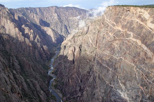 Scenic Viewpoint
Cedar Point Overlook
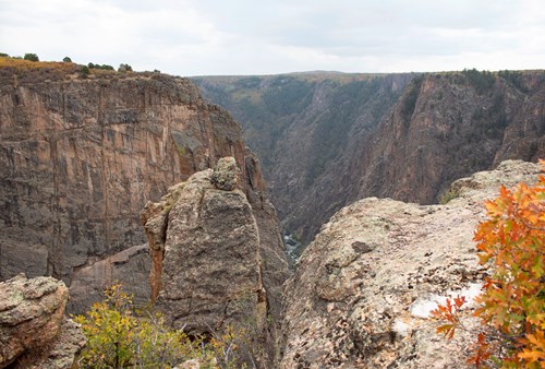 Scenic Viewpoint
Balanced Rock Overlook
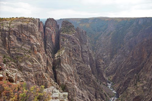 Scenic Viewpoint
Big Island Overlook
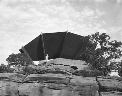 Scenic Viewpoint
Bookcliff View Shelter
 Scenic Viewpoint
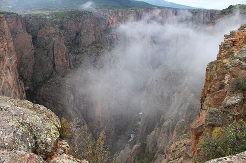
Chasm View Overlook
 Scenic Viewpoint
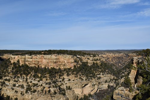
Cliff Canyon Overlook
 Scenic Viewpoint
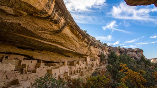
Cliff Palace Overlook
 Scenic Viewpoint
Cliff Palace View
Scenic ViewpointAnimas Overlook
Scenic ViewpointArtists Point
Scenic ViewpointBadger House Overlook
Scenic ViewpointBook Cliff View
Scenic Viewpoints by county
All scenic viewpoints (59)
| Name | County | Elevation | Nearest town | Sky |
|---|---|---|---|---|
| Cedar Point OverlookBlack Canyon Of The Gunnison | Montrose County | 2,134 m | Montrose | 2 |
| Balanced Rock OverlookBlack Canyon Of The Gunnison | Montrose County | — | Montrose | 2 |
| Big Island OverlookBlack Canyon Of The Gunnison | Montrose County | — | Montrose | 2 |
| Bookcliff View ShelterColorado | Mesa County | — | Fruita | 4 |
| Chasm View OverlookBlack Canyon Of The Gunnison | Montrose County | — | Montrose | 2 |
| Cliff Canyon OverlookMesa Verde | Montezuma County | — | Cortez | 2 |
| Cliff Palace OverlookMesa Verde | Montezuma County | — | Cortez | 2 |
| Cliff Palace ViewMesa Verde | Montezuma County | — | Cortez | 2 |
| Animas Overlook | La Plata County | 2,548 m | Durango | 3 |
| Artists PointColorado | Mesa County | 1,879 m | Redlands | 4 |
| Badger House OverlookMesa Verde | Montezuma County | 2,054 m | Cortez | 2 |
| Book Cliff ViewColorado | Mesa County | 1,665 m | Fruita | 4 |
| Coke Ovens OverlookColorado | Mesa County | 1,905 m | Redlands | 4 |
| Cold Shivers PointColorado | Mesa County | 1,845 m | Redlands | 5 |
| Cross Fissures Overlook IIBlack Canyon Of The Gunnison | Montrose County | 2,347 m | Montrose | 2 |
| Deep Creek Overlook | Garfield County | 2,974 m | Glenwood Springs | 2 |
| Dillon Overlook | Summit County | 2,763 m | Silverthorne | 5 |
| Distant ViewColorado | Mesa County | 1,716 m | Fruita | 4 |
| Dolores Canyon Overlook Picnic Area | Dolores County | 2,442 m | Monticello | 1 |
| Fallen Rock OverlookColorado | Mesa County | 1,986 m | Redlands | 4 |
| Fruita Canyon ViewColorado | Mesa County | 1,740 m | Fruita | 4 |
| Grand ViewColorado | Mesa County | 1,813 m | Fruita | 4 |
| Highland ViewColorado | Mesa County | 1,924 m | Redlands | 4 |
| Historic Trail View | Mesa County | 1,530 m | Fruita | 5 |
| Land O Lakes Overlook | Delta County | 3,274 m | Cedaredge | 2 |
| Lands End Overlook Picnic Ground | Mesa County | 3,383 m | Crested Butte | 2 |
| Mancos Valley OverlookMesa Verde | Montezuma County | 2,381 m | Mancos | 2 |
| Moccasin OverlookMesa Verde | Montezuma County | 2,539 m | Cortez | 2 |
| Moffat Overlook | Grand County | 2,781 m | Fraser | 4 |
| Montezuma Valley OverlookMesa Verde | Montezuma County | 2,383 m | Cortez | 2 |
| North Clear Creek Falls Overlook | Hinsdale County | 3,067 m | Ouray | 1 |
| Overlook Athletic Club Heliport | Summit County | 3,069 m | Breckenridge | 5 |
| Overlook Point | La Plata County | 3,956 m | Durango | 1 |
| Overlook Reservoir Number One | Dolores County | 2,365 m | Monticello | 1 |
| Pioneer Lookout PointCurecanti | Gunnison County | 2,449 m | Montrose | 2 |
| Pulpit Rock OverlookBlack Canyon Of The Gunnison | Montrose County | 2,461 m | Montrose | 2 |
| Red Canyon OverlookColorado | Mesa County | 1,958 m | Redlands | 4 |
| Ridge Point Overlook | Montezuma County | 2,218 m | Cortez | 2 |
| Sally Overlook | Archuleta County | 2,582 m | Pagosa Springs | 1 |
| Sapphire Point Overlook | Summit County | 2,900 m | Frisco | 4 |
| Soda Canyon OverlookMesa Verde | Montezuma County | 2,075 m | Cortez | 2 |
| Tabeguache Overlook | Montrose County | 2,835 m | Olathe | 1 |
| Virgins Bath Overlook | Douglas County | 2,678 m | Perry Park | 4 |
| Windy Point Overlook | Hinsdale County | 3,293 m | Ouray | 1 |
| Davis Overlook | Park County | 3,164 m | Breckenridge | 3 |
| Escalante Overlook | Moffat County | 2,357 m | Rangely | 1 |
| Forest Canyon OverlookRocky Mountain | Larimer County | 3,567 m | Estes Park | 3 |
| Gore Range OverlookRocky Mountain | Larimer County | 3,663 m | Estes Park | 3 |
| Harding Hole OverlookDinosaur | Moffat County | 1,765 m | Rangely | 1 |
| Soda Balcony OverlookMesa Verde | Montezuma County | 2,039 m | Cortez | 2 |
| Kodak House OverlookMesa Verde | Montezuma County | 2,008 m | Towaoc | 2 |
| Long House OverlookMesa Verde | Montezuma County | 2,103 m | Towaoc | 2 |
| Park Point OverlookMesa Verde | Montezuma County | 2,611 m | Cortez | 2 |
| Redlands ViewColorado | Mesa County | 1,518 m | Fruita | 5 |
| Balanced Rock ViewColorado | Mesa County | 1,573 m | Fruita | 4 |
| Independence Monument ViewColorado | Mesa County | 1,788 m | Fruita | 4 |
| Monument Canyon ViewColorado | Mesa County | 1,827 m | Redlands | 4 |
| Upper Ute Canyon OverlookColorado | Mesa County | 1,945 m | Redlands | 4 |
| Ute Canyon ViewColorado | Mesa County | 1,975 m | Redlands | 4 |
Sky = estimated Bortle class (1 darkest – 9 brightest).
Map
How to photograph scenic viewpoints
Overlooks are about the sweep of the land, so low-angle light matters most: side-light at sunrise or sunset reveals ridges and texture that midday sun flattens.
- Arrive 30–45 minutes before sunrise or sunset to find a composition before the light peaks.
- Use a telephoto (70–200 mm) to isolate layered ridges and light rays instead of shooting only wide.
- Check the sun azimuth for your date: front-light, side-light and back-light give three different pictures from the same rail.
- Haze builds in summer afternoons; mornings after a cold front are often the clearest.
- Stay behind barriers — many overlook edges are undercut or crumbly.
Season: Clear, dry air in autumn and after winter storms gives the longest views; summer adds wildflowers but also haze.