Top scenic viewpoints
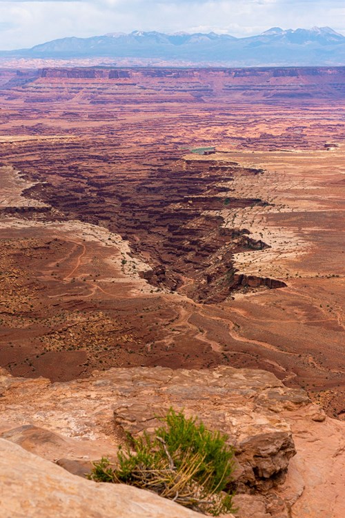 Scenic Viewpoint
Buck Canyon Overlook
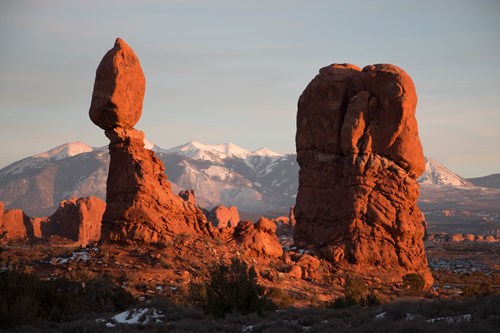 Scenic Viewpoint
Balanced Rock Viewpoint and Trail
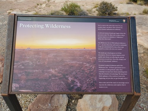 Scenic Viewpoint
Big Spring Canyon Overlook: Protecting Wilderness
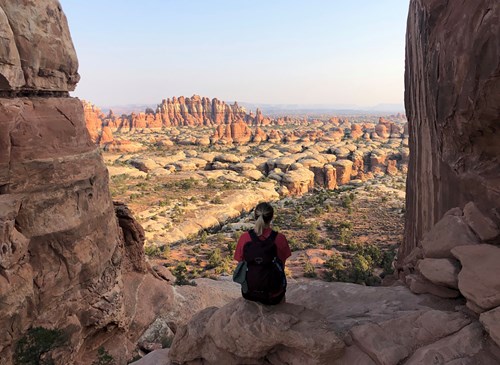 Scenic Viewpoint
Chesler Park Viewpoint Trail
 Scenic Viewpoint
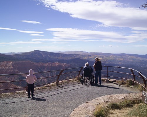
Chessmen Ridge Overlook
 Scenic Viewpoint
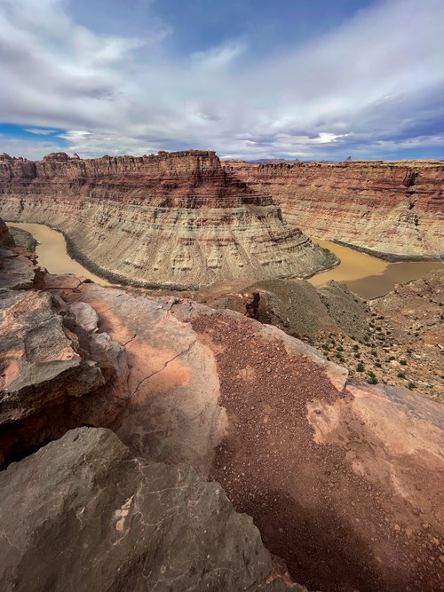
Confluence Overlook Trail
 Scenic Viewpoint
Colorado River Overlook
Scenic ViewpointCandlestick Tower Overlook
Scenic ViewpointAgua Canyon Overlook
Scenic ViewpointAnticline Overlook
Scenic ViewpointArch Canyon Overlook
Scenic ViewpointArch Canyon Overlook
Scenic Viewpoints by county
- Daggett County4
- Davis County4
- Emery County5
- Garfield County15
- Grand County11
- Iron County3
- Kane County6
- San Juan County24
- Sanpete County3
- Uintah County8
- Wasatch County3
- Washington County3
- Wayne County7
All scenic viewpoints (106)
| Name | County | Elevation | Nearest town | Sky |
|---|---|---|---|---|
| Buck Canyon OverlookCanyonlands | San Juan County | 1,881 m | Moab | 1 |
| Balanced Rock Viewpoint and TrailArches | Grand County | — | Moab | 2 |
| Big Spring Canyon Overlook: Protecting WildernessCanyonlands | San Juan County | — | Moab | 1 |
| Chesler Park Viewpoint TrailCanyonlands | San Juan County | — | Monticello | 1 |
| Chessmen Ridge OverlookCedar Breaks | Iron County | — | Cedar City | 2 |
| Confluence Overlook TrailCanyonlands | San Juan County | — | Moab | 1 |
| Colorado River OverlookCanyonlands | San Juan County | 1,453 m | Moab | 1 |
| Candlestick Tower OverlookCanyonlands | Grand County | — | Moab | 1 |
| Agua Canyon OverlookBryce Canyon | Kane County | 2,669 m | Panguitch | 1 |
| Anticline Overlook | San Juan County | 1,737 m | Moab | 2 |
| Arch Canyon Overlook | San Juan County | 2,573 m | Blanding | 1 |
| Arch Canyon Overlook | San Juan County | 2,065 m | Blanding | 1 |
| Bagpipe Butte OverlookCanyonlands | Wayne County | 2,024 m | Moab | 1 |
| Beaver Dam Overlook | Utah County | 2,638 m | Elk Ridge | 4 |
| Big Spring Canyon OverlookCanyonlands | San Juan County | 1,548 m | Monticello | 1 |
| Black Birch Canyon OverlookBryce Canyon | Kane County | 2,673 m | Panguitch | 1 |
| Bryce Point OverlookBryce Canyon | Garfield County | 2,535 m | Panguitch | 1 |
| Bullfrog Creek Overlook | Garfield County | 1,503 m | Page | 1 |
| Butler Wash Viewpoint | San Juan County | 1,803 m | Blanding | 1 |
| Canyon OverlookZion | Washington County | 1,808 m | Hildale | 2 |
| Canyonlands OverlookCanyonlands | San Juan County | 1,783 m | Moab | 1 |
| Castle Valley Overlook | Grand County | 2,533 m | Moab | 1 |
| Chessmen OverlookCedar Breaks | Iron County | 3,196 m | Cedar City | 2 |
| Confluence OverlookCanyonlands | San Juan County | 1,434 m | Moab | 1 |
| Dead Horse Point Overlook | San Juan County | 1,807 m | Moab | 1 |
| Upper Delicate Arch ViewpointArches | Grand County | 1,346 m | Moab | 1 |
| Desert Overlook | Garfield County | 3,283 m | Moab | 1 |
| Fairview Lakes Overlook | Sanpete County | 2,839 m | Fairview | 3 |
| Fairyland Point OverlookBryce Canyon | Garfield County | 2,371 m | Panguitch | 1 |
| Farview Point OverlookBryce Canyon | Garfield County | 2,690 m | Panguitch | 1 |
| Ferron Canyon Overlook | Emery County | 2,503 m | Ferron | 2 |
| Fiery Furnace ViewpointArches | Grand County | 1,449 m | Moab | 1 |
| Flint Trail Overlook | Garfield County | 2,088 m | Moab | 1 |
| Goosenecks OverlookCapitol Reef | Wayne County | 1,938 m | Richfield | 1 |
| Grand View Point OverlookCanyonlands | San Juan County | 1,909 m | Moab | 1 |
| Green River OverlookCanyonlands | San Juan County | 1,824 m | Moab | 1 |
| Inspiration Point OverlookBryce Canyon | Garfield County | 2,487 m | Panguitch | 1 |
| Joes Valley Overlook | Emery County | 2,340 m | Orangeville | 2 |
| Johnson Ridge Overlook | Sanpete County | 2,784 m | Fairview | 3 |
| Kolob Canyons ViewpointZion | Washington County | 1,883 m | Toquerville | 2 |
| La Sal Mountains ViewpointArches | Grand County | 1,283 m | Moab | 3 |
| Lake Powell Overlook | Garfield County | 1,301 m | Moab | 1 |
| Lookout Point | Emery County | 1,831 m | Ferron | 1 |
| Maverick Point Overlook | San Juan County | 2,446 m | Monticello | 1 |
| Maze OverlookCanyonlands | Wayne County | 1,581 m | Moab | 1 |
| Mill Creek Canyon Overlook | Grand County | 2,411 m | Moab | 1 |
| Millard Canyon OverlookCanyonlands | Wayne County | 1,891 m | Moab | 1 |
| Moki Dugway Overlook | San Juan County | 1,956 m | Blanding | 1 |
| Montezuma Creek Overlook | San Juan County | 1,600 m | Blanding | 1 |
| Monument Valley OverlookNatural Bridges | San Juan County | 2,078 m | Blanding | 1 |
| Muley Point Overlook | San Juan County | 1,938 m | Kayenta | 1 |
| Murphy Point OverlookCanyonlands | San Juan County | 1,867 m | Moab | 1 |
| Natural Bridge OverlookBryce Canyon | Kane County | 2,436 m | Panguitch | 1 |
| Overlook Ridge | Grand County | 2,529 m | Loma | 1 |
| Overlook pointZion | Washington County | 1,665 m | Hildale | 3 |
| Panorama Point OverlookCanyonlands | Wayne County | 1,683 m | Moab | 1 |
| Paria View OverlookBryce Canyon | Garfield County | 2,495 m | Panguitch | 1 |
| Piracy Point OverlookBryce Canyon | Garfield County | 2,685 m | Panguitch | 1 |
| Ponderosa Canyon OverlookBryce Canyon | Kane County | 2,684 m | Panguitch | 1 |
| Rainbow Point OverlookBryce Canyon | Kane County | 2,664 m | Panguitch | 1 |
| Salt Valley OverlookArches | Grand County | 1,433 m | Moab | 1 |
| Sanpete Valley Overlook | Sanpete County | 2,975 m | Fairview | 2 |
| South Desert OverlookCapitol Reef | Wayne County | 1,771 m | Richfield | 1 |
| Strike Valley Overlook | Garfield County | 1,831 m | Page | 1 |
| Sunrise Point OverlookBryce Canyon | Garfield County | 2,439 m | Panguitch | 1 |
| Sunset Point OverlookBryce Canyon | Garfield County | 2,432 m | Panguitch | 1 |
| Swamp Canyon OverlookBryce Canyon | Garfield County | 2,454 m | Panguitch | 1 |
| The Needles OverlookCanyonlands | San Juan County | 1,868 m | Moab | 1 |
| The Wedge Overlook | Emery County | 1,884 m | Castle Dale | 2 |
| Wedge Overlook | Emery County | 1,808 m | Castle Dale | 2 |
| White Mesa Overlook | San Juan County | 1,653 m | Blanding | 1 |
| Yovimpa Point OverlookBryce Canyon | Kane County | 2,775 m | Panguitch | 1 |
| Zion Overlook | Iron County | 2,522 m | Cedar City | 3 |
| Pelican Overlook | Sevier County | 2,787 m | Monroe | 1 |
| Overlook Gas Field | Grand County | 2,106 m | Loma | 1 |
| Long Canyon Overlook | Garfield County | 1,955 m | Page | 1 |
| Bald Mountain Overlook | Wasatch County | 3,269 m | Kamas | 3 |
| Bear Lake Overlook | Cache County | 2,300 m | Richmond | 3 |
| Bountiful Peak Overlook | Davis County | 2,711 m | Farmington | 5 |
| Brush Creek Canyon Overlook | Uintah County | 2,503 m | Maeser | 2 |
| Centerville Canyon Overlook | Davis County | 2,332 m | Centerville | 6 |
| Doc Valley Overlook | Uintah County | 2,313 m | Naples | 2 |
| Dowd Mountain Overlook Picnic Area | Daggett County | 2,332 m | Maeser | 2 |
| Dry Fork Overlook | Uintah County | 2,857 m | Maeser | 2 |
| Flamingo Gorge Overlook | Daggett County | 2,218 m | Maeser | 2 |
| Francis Peak Overlook | Morgan County | 2,833 m | Fruit Heights | 5 |
| Greensdale Overlook | Daggett County | 2,260 m | Maeser | 2 |
| Iron Springs Bench Overlook | Uintah County | 2,346 m | Naples | 1 |
| Island Park Overlook | Uintah County | 2,300 m | Naples | 1 |
| Kolob Basin Overlook | Utah County | 2,603 m | Springville | 6 |
| Little Mountain Overlook | Uintah County | 2,623 m | Maeser | 2 |
| Lookout Point | Duchesne County | 2,604 m | Francis | 3 |
| Provo River Falls Overlook | Wasatch County | 2,861 m | Kamas | 3 |
| Provo River Overlook | Summit County | 2,348 m | Francis | 3 |
| Red Canyon Overlook | Daggett County | 2,240 m | Maeser | 2 |
| Silvestre Overlook | Uintah County | 1,579 m | Ballard | 2 |
| Slate Gorge Overlook | Summit County | 2,746 m | Kamas | 3 |
| Soldier Creek Overlook | Wasatch County | 2,400 m | Mapleton | 3 |
| Split Mountain Overlook | Uintah County | 2,321 m | Naples | 1 |
| Steed Creek Overlook | Davis County | 2,536 m | Farmington | 6 |
| Viewpoint | Salt Lake County | 1,283 m | Magna | 5 |
| Ward Canyon Overlook | Davis County | 1,927 m | Centerville | 7 |
| Wilderness Area Overlook | Duchesne County | 3,193 m | Kamas | 3 |
| Shafer Canyon OverlookCanyonlands | San Juan County | 1,770 m | Moab | 1 |
| Park Avenue ViewpointArches | Grand County | 1,324 m | Moab | 3 |
| Panorama PointCapitol Reef | Wayne County | 1,881 m | Richfield | 1 |
Sky = estimated Bortle class (1 darkest – 9 brightest).
Map
How to photograph scenic viewpoints
Overlooks are about the sweep of the land, so low-angle light matters most: side-light at sunrise or sunset reveals ridges and texture that midday sun flattens.
- Arrive 30–45 minutes before sunrise or sunset to find a composition before the light peaks.
- Use a telephoto (70–200 mm) to isolate layered ridges and light rays instead of shooting only wide.
- Check the sun azimuth for your date: front-light, side-light and back-light give three different pictures from the same rail.
- Haze builds in summer afternoons; mornings after a cold front are often the clearest.
- Stay behind barriers — many overlook edges are undercut or crumbly.
Season: Clear, dry air in autumn and after winter storms gives the longest views; summer adds wildflowers but also haze.