Top scenic viewpoints
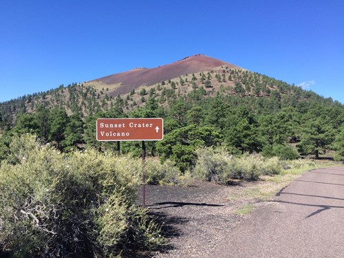 Scenic Viewpoint
Cinder Hills Overlook
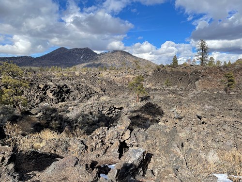 Scenic Viewpoint
A'a Overlook
 Scenic Viewpoint
Accessible Scenic Overlook
Scenic ViewpointFort Grant Vista Point
Scenic ViewpointAjo Mine Lookout
Scenic ViewpointCastle Rock
Scenic ViewpointCentella Point
Scenic ViewpointWagon Massacre Site
Scenic ViewpointSea Captain
Scenic ViewpointMonte Vista Peak Lookout
Scenic ViewpointMount Ord Lookout Tower
Scenic ViewpointBuck Mountain Lookout Tower
Scenic Viewpoints by county
- Apache County13
- Cochise County24
- Coconino County18
- Gila County13
- Graham County5
- Maricopa County28
- Mohave County4
- Navajo County10
- Pima County19
- Pinal County7
- Yavapai County12
All scenic viewpoints (158)
| Name | County | Elevation | Nearest town | Sky |
|---|---|---|---|---|
| Cinder Hills OverlookSunset Crater Volcano | Coconino County | 2,152 m | Flagstaff | 3 |
| A'a OverlookSunset Crater Volcano | Coconino County | — | Flagstaff | 3 |
| Accessible Scenic OverlookWalnut Canyon | Coconino County | — | Flagstaff | 4 |
| Fort Grant Vista Point | Graham County | 2,852 m | Swift Trail Junction | 2 |
| Ajo Mine Lookout | Pima County | — | Ajo | 4 |
| Castle Rock | Cochise County | 1,660 m | Bisbee | 5 |
| Centella Point | Cochise County | 2,809 m | Douglas | 1 |
| Wagon Massacre Site | Cochise County | — | Willcox | 2 |
| Sea CaptainChiricahua | Cochise County | — | Willcox | 1 |
| Monte Vista Peak Lookout | Cochise County | 2,826 m | Pirtleville | 1 |
| Mount Ord Lookout Tower | Maricopa County | 2,168 m | Tonto Basin | 4 |
| Buck Mountain Lookout Tower | Coconino County | 2,312 m | Pine | 3 |
| Horsethief Lookout Tower | Yavapai County | 2,041 m | Black Canyon City | 4 |
| The Lookout | Maricopa County | 1,176 m | Fountain Hills | 5 |
| Spruce Mountain Lookout | Yavapai County | 2,327 m | Prescott | 4 |
| Nelson Lake Point | Coconino County | 2,232 m | Heber-Overgaard | 2 |
| O'Haco Lookout Tower | Coconino County | 2,329 m | Star Valley | 3 |
| P S Knoll Lookout Tower | Greenlee County | 2,449 m | Eagar | 2 |
| McFadden Peak Lookout | Gila County | 2,167 m | Tonto Basin | 3 |
| Buckskin Lookout Tower | Navajo County | 2,236 m | Heber-Overgaard | 2 |
| Greens Peak Lookout | Apache County | 3,073 m | Eagar | 2 |
| Deer Springs Lookout | Navajo County | 2,210 m | Heber-Overgaard | 2 |
| Gentry Lookout Tower | Coconino County | 2,355 m | Heber-Overgaard | 2 |
| Promontory Butte Lookout | Gila County | 2,402 m | Star Valley | 3 |
| Barrier-Free Lookout | Pinal County | — | Superior | 4 |
| Show Low Meadow | Navajo County | — | Show Low | 5 |
| Horseshoe Vista | Gila County | — | Star Valley | 3 |
| Aztec Spring Ranch | Navajo County | — | Heber-Overgaard | 2 |
| Juniper Ridge Lookout Tower | Navajo County | 2,134 m | Linden | 4 |
| Railroad Depot Overlook | La Paz County | — | Cienega Springs | 2 |
| Pilot Rock | Mohave County | — | Lake Havasu City | 4 |
| Overlook | Pinal County | — | Eloy | 4 |
| Bull Pasture Viewpoint | Pima County | — | Ajo | 2 |
| Ambush Saddle Viewpoint | Cochise County | — | Douglas | 1 |
| Red Rocks | Cochise County | — | Douglas | 1 |
| Winn Falls Viewpoint | Cochise County | — | Douglas | 1 |
| Cathedral Vista Point | Cochise County | — | Douglas | 1 |
| Silver Peak Lookout | Cochise County | — | Douglas | 1 |
| Seven Cateracts VistaSaguaro | Pima County | — | Tanque Verde | 5 |
| Coronado Memorial Overlook | Cochise County | — | Sierra Vista Southeast | 3 |
| Gates Pass | Pima County | — | Tucson Estates | 6 |
| Thimble Mountain VistaSaguaro | Pima County | — | Tanque Verde | 5 |
| Chiricahua Vista Helispot | Cochise County | — | Douglas | 1 |
| Mountain Viewpoint | Cochise County | — | Benson | 3 |
| San Pedro VistaSaguaro | Pima County | — | Tanque Verde | 4 |
| Windy PointSaguaro | Pima County | — | Tanque Verde | 4 |
| Geology VistaSaguaro | Pima County | — | Tanque Verde | 4 |
| Upper Rucker Canyon Viewpoint | Cochise County | — | Pirtleville | 1 |
| Heliograph Peak Fire Lookout Tower | Graham County | — | Swift Trail Junction | 2 |
| Paint Rock Viewpoint | Cochise County | — | Pirtleville | 1 |
| Rucker Canyon Viewpoint | Cochise County | — | Pirtleville | 1 |
| Ward Canyon Overlook | Cochise County | — | Douglas | 1 |
| Carr Canyon Waterfall | Cochise County | — | Sierra Vista Southeast | 4 |
| Desert Living OverlookSaguaro | Pima County | — | Tanque Verde | 5 |
| Future Generations OverlookSaguaro | Pima County | — | Tanque Verde | 5 |
| Cactus Forest OverlookSaguaro | Pima County | — | Tanque Verde | 5 |
| Rincon Mountains OverlookSaguaro | Pima County | — | Tanque Verde | 5 |
| Montezuma Pass Viewpoint | Cochise County | — | Sierra Vista Southeast | 3 |
| Wildlife Viewing Area | Pinal County | — | Oracle | 4 |
| Chiricahua Mountains WildernesChiricahua | Cochise County | — | Willcox | 1 |
| Stream BedsChiricahua | Cochise County | — | Willcox | 1 |
| 600 West Vuelta Buril | Pima County | — | Sahuarita | 6 |
| Webb Peak Fire Lookout Tower | Graham County | — | Swift Trail Junction | 2 |
| West Peak Fire Lookout Tower | Graham County | — | Pima | 2 |
| Babad Do'ag ViewpointSaguaro | Pima County | — | Tanque Verde | 5 |
| Molino Canyon VistaSaguaro | Pima County | — | Tanque Verde | 5 |
| US Border Patrol Camera Tower | Cochise County | — | Pirtleville | 3 |
| Lost Dog Overlook | Maricopa County | — | Fountain Hills | 6 |
| Taliesin Overlook | Maricopa County | — | Fountain Hills | 6 |
| Giraffe Overlook | Maricopa County | — | Tempe Junction | 9 |
| Skull Valley Overlook | Yavapai County | — | Prescott | 4 |
| Bobby's Rock | Maricopa County | — | Paradise Valley | 8 |
| The Amphitheater | Maricopa County | — | Carefree | 5 |
| Scenic View | Maricopa County | — | Carefree | 5 |
| Basalt Ridge Overlook | Maricopa County | — | Carefree | 5 |
| Hell's Hole Overlook | Yavapai County | — | Black Canyon City | 4 |
| Observation Deck | Yavapai County | — | Congress | 3 |
| Overlook | Maricopa County | — | Ahwatukee Foothills | 7 |
| Casey House | Maricopa County | — | Ahwatukee Foothills | 7 |
| Echo Canyon Viewpoint | Maricopa County | — | Paradise Valley | 8 |
| Inspiration Viewpoint | Maricopa County | — | Fountain Hills | 5 |
| Mount Union Lookout | Yavapai County | — | Prescott | 4 |
| Three Sisters | Pinal County | — | Gold Canyon | 5 |
| High View Point | Gila County | — | Pine | 3 |
| Hi View Point | Gila County | — | Pine | 3 |
| Sunset Vista | Maricopa County | — | Carefree | 5 |
| The Lookout | Pinal County | — | Arizona City | 5 |
| Grandview | Maricopa County | — | Carefree | 5 |
| Prospector Scenic View | Maricopa County | — | Fountain Hills | 5 |
| Mushroom Rock Scenic Point | Maricopa County | — | Rio Verde | 5 |
| Harris's Hawk Vista | Maricopa County | — | Fountain Hills | 5 |
| Raven Roost Scenic View | Maricopa County | — | Fountain Hills | 5 |
| Vulture View Scenic Point | Maricopa County | — | Fountain Hills | 5 |
| Prairie Falcon Overlook | Maricopa County | — | Fountain Hills | 5 |
| Owl's Rest | Maricopa County | — | Carefree | 5 |
| High Point(2889') | Maricopa County | — | Carefree | 5 |
| Sidewinder Overlook | Maricopa County | — | Carefree | 5 |
| Oasis Overlook | Yavapai County | — | Black Canyon City | 4 |
| Lake Pleasant Overlook | Yavapai County | — | New River | 4 |
| Gila and Salt River Initial Point monument | Maricopa County | — | Avondale | 6 |
| Humboldt Mountain Lookout Tower | Maricopa County | — | Carefree | 4 |
| Military Sinkhole Observation Site | Gila County | — | Star Valley | 3 |
| Rim Lakes Vista Point | Gila County | — | Star Valley | 3 |
| Woods Canyon Vista Point | Gila County | — | Star Valley | 3 |
| Weaver's Needle Lookout | Pinal County | — | Superior | 4 |
| Observation Lookout | Pinal County | — | Superior | 4 |
| Pat Mullen Scenic Vista | Navajo County | — | Pinetop-Lakeside | 3 |
| Bull Canyon Viewpoint | Gila County | — | Claypool | 3 |
| Bull Canyon Viewpoint | Gila County | — | Claypool | 3 |
| Roosevelt Diversion Dam | Gila County | — | Claypool | 3 |
| Springer Mountain Lookout Tower | Navajo County | — | Pinetop-Lakeside | 5 |
| Aztec Peak Lookout Tower | Gila County | — | Tonto Basin | 3 |
| Diamond Point Lookout Tower | Gila County | — | Star Valley | 3 |
| Willow Mountain Fire Lookout | Graham County | — | Morenci | 2 |
| Siphon Outlet | Yuma County | — | Yuma | 7 |
| Dunas de arena | Pima County | — | Fortuna Foothills | 1 |
| Saguaro Danzante | Pima County | — | Fortuna Foothills | 2 |
| Guard Tower | Yuma County | — | Yuma | 7 |
| Blue Vista Scenic Overlook | Greenlee County | 2,799 m | Morenci | 1 |
| Canyon Viewpoint | Mohave County | 1,435 m | Peach Springs | 2 |
| Desert Vista Viewpoint | Maricopa County | 747 m | Rio Verde | 4 |
| East Rim Viewpoint | Coconino County | 2,665 m | Grand Canyon | 1 |
| Grandview Overlook | Apache County | 2,706 m | Eagar | 2 |
| Granite Basin Viewpoint | Yavapai County | 1,831 m | Prescott | 4 |
| Hells Hole Overlook | Yavapai County | 2,020 m | Black Canyon City | 4 |
| Lookout PointGrand Canyon | Coconino County | 1,384 m | Grand Canyon Village | 1 |
| Lookout Point | Maricopa County | 934 m | Tonto Basin | 4 |
| Lookout Point | Navajo County | 1,710 m | Kayenta | 1 |
| Lookout Point Tank | Yavapai County | 1,886 m | Lake Montezuma | 3 |
| Marble Viewpoint | Coconino County | 2,704 m | Grand Canyon | 1 |
| Massacre Cave Overlook | Apache County | 2,071 m | Tsaile | 1 |
| Mummy Cave Overlook | Apache County | 1,842 m | Tsaile | 1 |
| Overlook Picnic AreaSaguaro | Pima County | 827 m | Tanque Verde | 5 |
| Overlook RidgeFort Bowie | Cochise County | 1,564 m | Willcox | 2 |
| Sierra Prieta Overlook | Yavapai County | 2,123 m | Prescott | 4 |
| Sliding Rock Overlook | Apache County | 1,953 m | Chinle | 2 |
| Spider Rock OverlookCanyon de Chelly | Apache County | 2,079 m | Chinle | 1 |
| Tri-State Viewpoint | Mohave County | 1,064 m | Bullhead City | 3 |
| Tsegi Overlook | Apache County | 1,781 m | Chinle | 4 |
| Tsegi Point OverlookNavajo | Navajo County | 2,223 m | Kayenta | 1 |
| Valley View Overlook Trail | Pima County | 808 m | Picture Rocks | 5 |
| White House Overlook | Apache County | 1,822 m | Chinle | 3 |
| Overlook Tanks | Coconino County | 2,150 m | Fredonia | 1 |
| LeFevre Overlook | Coconino County | 2,078 m | Fredonia | 1 |
| Grand Canyon Skywalk | Mohave County | 1,386 m | Meadview | 2 |
| Horseshoe BendGlen Canyon | Coconino County | 1,290 m | Page | 3 |
| Rustler Park Fire Guard Station | Cochise County | 2,821 m | Douglas | 1 |
| Desert View Watchtower | Coconino County | 2,272 m | Grand Canyon | 1 |
| Navajo Point | Coconino County | 2,272 m | Grand Canyon | 1 |
| Maricopa PointGrand Canyon | Coconino County | 2,150 m | Grand Canyon | 1 |
| Trail View OverlookGrand Canyon | Coconino County | 2,103 m | Grand Canyon Village | 1 |
| John Ford Point | Navajo County | 1,619 m | Kayenta | 1 |
| Antelope House Overlook | Apache County | 1,953 m | Chinle | 2 |
| Face Rock OverlookCanyon de Chelly | Apache County | 2,079 m | Chinle | 1 |
| Sliding House Overlook | Apache County | 1,832 m | Chinle | 2 |
| Junction Overlook | Apache County | 1,848 m | Chinle | 3 |
| Tunnel Overlook | Apache County | 1,767 m | Chinle | 4 |
| Wahweap OverlookGlen Canyon | Coconino County | 1,293 m | Page | 3 |
Sky = estimated Bortle class (1 darkest – 9 brightest).
Map
How to photograph scenic viewpoints
Overlooks are about the sweep of the land, so low-angle light matters most: side-light at sunrise or sunset reveals ridges and texture that midday sun flattens.
- Arrive 30–45 minutes before sunrise or sunset to find a composition before the light peaks.
- Use a telephoto (70–200 mm) to isolate layered ridges and light rays instead of shooting only wide.
- Check the sun azimuth for your date: front-light, side-light and back-light give three different pictures from the same rail.
- Haze builds in summer afternoons; mornings after a cold front are often the clearest.
- Stay behind barriers — many overlook edges are undercut or crumbly.
Season: Clear, dry air in autumn and after winter storms gives the longest views; summer adds wildflowers but also haze.